1
of
8
Loading...
Agisoft | SKU:
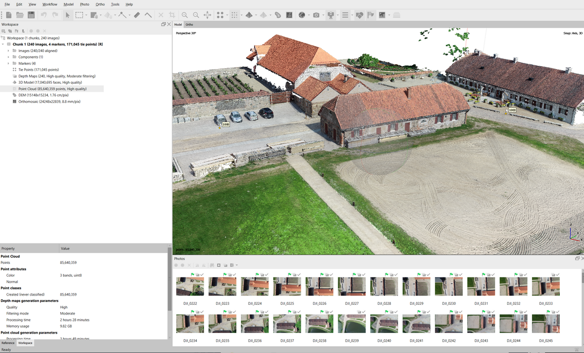
Agisoft Metashape Photogrammetry Software
CAD 4,999
Agisoft Metashape
is an advanced stand-alone photogrammetry software designed for creating accurate 3D models and geospatial data from digital images. It's an essential tool for professionals in industries such as GIS, architecture, cultural heritage documentation, and visual effects production.
Key Features:
- Photogrammetric Triangulation: Automatically aligns and triangulates images to create detailed 3D spatial data.
- Dense Point Cloud Generation: Allows the creation of dense point clouds with advanced editing and classification features, perfect for further processing in traditional workflows.
- 3D Model Creation and Texturing: Capable of generating highly detailed 3D models with realistic textures from aerial and close-range imagery, supporting formats like Sketchfab for direct upload.
- Georeferenced Orthomosaic and DEM Creation: Produces highly accurate georeferenced orthomosaics and digital elevation models (DSM/DTM), crucial for GIS applications.
- Stereoscopic Measurements: Supports stereoscopic measurements using professional 3D monitors and controllers for high-precision data collection.
- Laser Scanning Integration: Metashape seamlessly integrates with laser scanning data, allowing the combination of photogrammetry and LiDAR point clouds for enhanced 3D modeling. This feature is especially beneficial for applications requiring the highest accuracy, such as topographic mapping, infrastructure inspection, and heritage preservation.
- Multispectral Imagery Processing: Supports RGB, NIR, and thermal multispectral imagery processing, allowing users to create multispectral orthomosaics and calculate vegetation indices like NDVI.
- 4D Modeling for Dynamic Scenes: Capable of handling multi-camera station data, making it ideal for projects in cinematography, game development, and other creative industries.
Ideal for:
- Surveying and Mapping: Create accurate and detailed 3D maps and models for various topographic and infrastructural projects.
- Architecture and Construction: Document and visualize sites in 3D with high precision, integrating laser scan data for comprehensive modeling.
- Cultural Heritage Documentation: Accurately capture and preserve historical sites and artifacts in 3D.
- Visual Effects and Media Production: Generate photorealistic 3D models for use in films, games, and other digital media.
Agisoft Metashape
is available in both Standard and Professional editions, with the Professional version offering extended capabilities such as ground control point support, multispectral processing, and advanced geospatial outputs.
Metashape features
Agisoft Metashape — Intelligent photogrammetry
enhanced with LiDAR data processing