
CHCNAV AlphaAir 10 Professional UAV LiDAR solution for corridor mapping and infrastructure inspection
AlphaAir 10 LiDAR + Full-Frame RGB System
A Professional UAV LiDAR Solution for High-Precision 3D Mapping
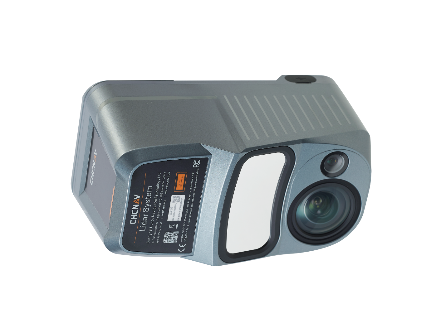
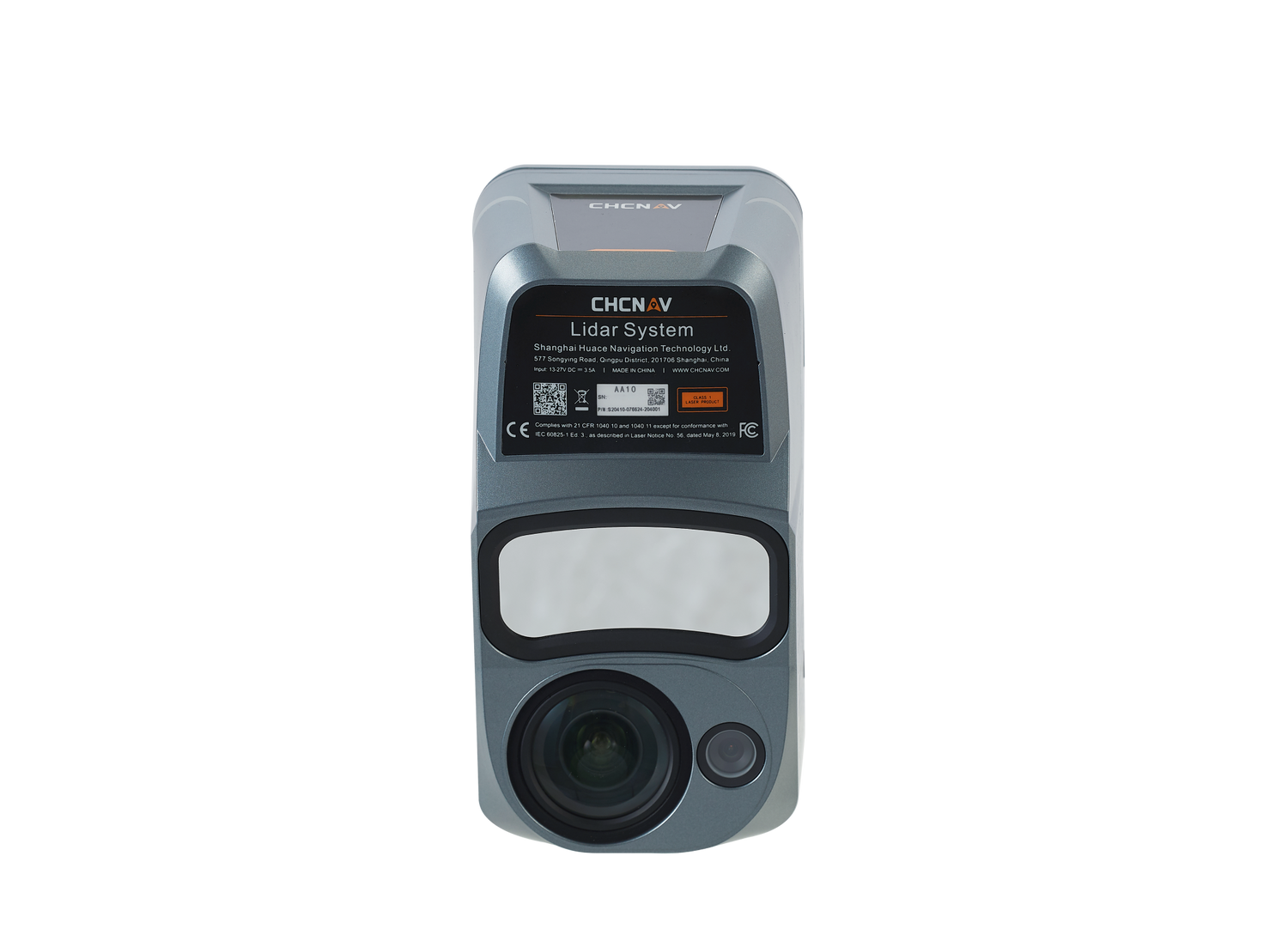
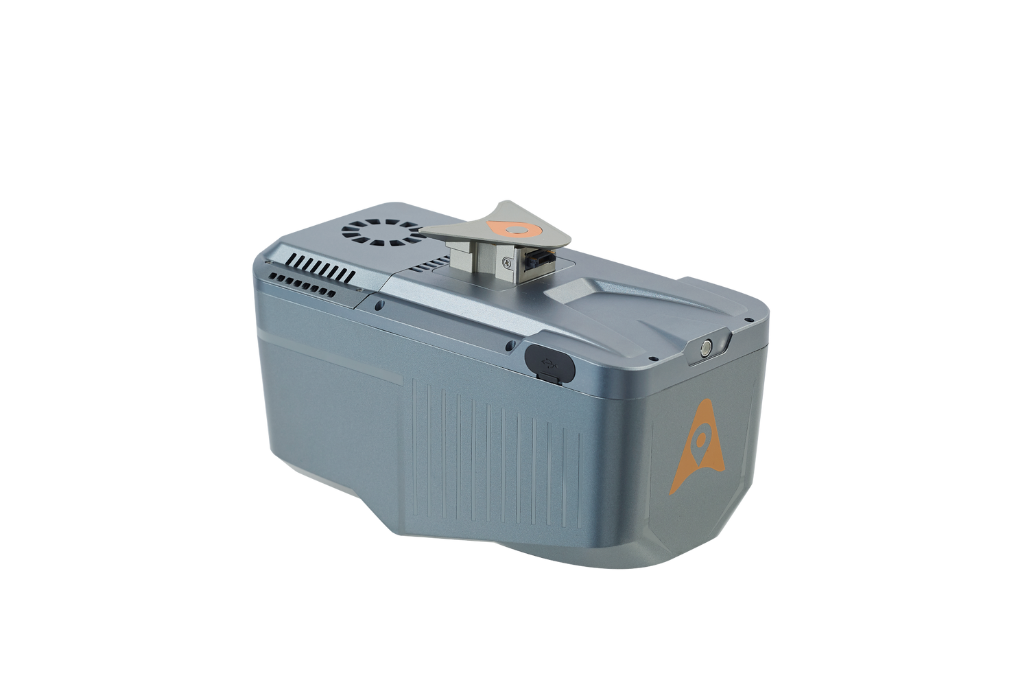
The CHCNAV AlphaAir 10 (AA10) is a high-end airborne LiDAR solution designed for professionals requiring precise, full-featured UAV mapping in demanding environments. Combining a powerful laser scanner, tightly integrated GNSS/IMU, and an industrial 45 MP orthographic camera, the AA10 provides survey-grade 3D point clouds and vivid RGB imagery—all captured in a single flight.
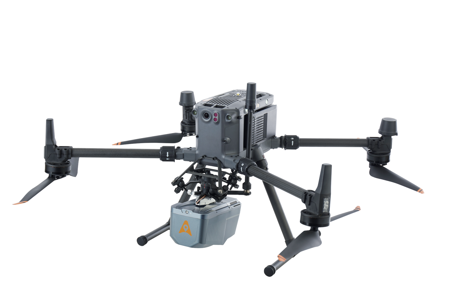
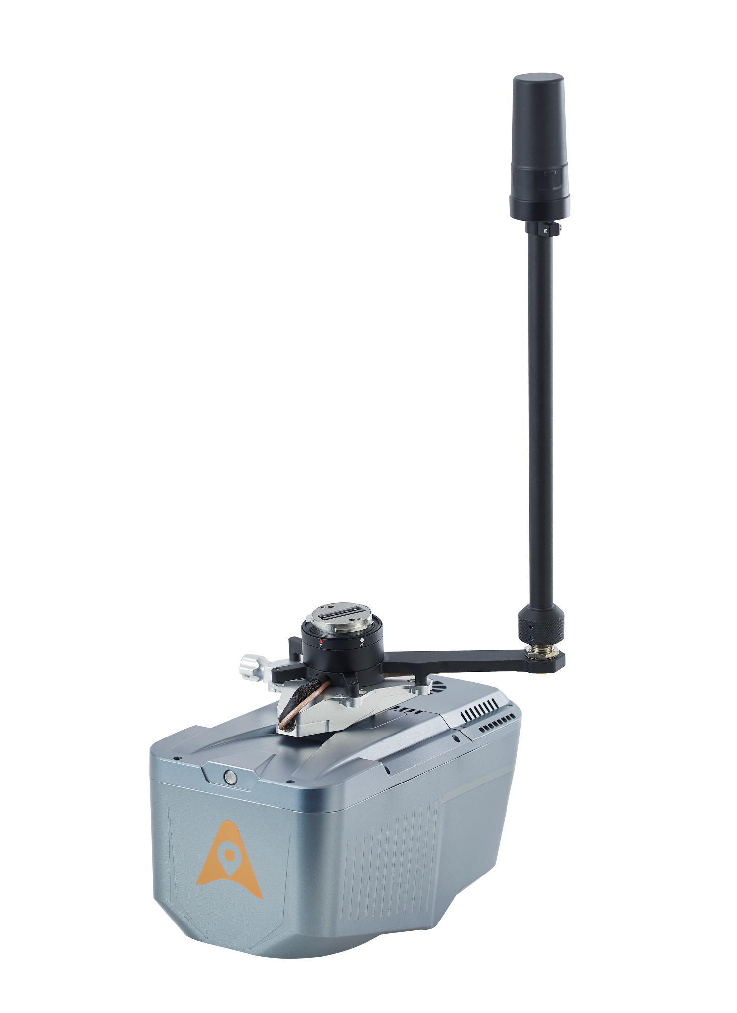
Designed for seamless integration with UAV platforms such as the CHCNAV X500, DJI M350 and third-party drones, the AA10 delivers consistent performance with its compact, lightweight form factor and CHCNAV’s AlphaPort one-click mount and power interface.
Key Features
Survey-Grade Precision with Long-Range Reach
• Achieve absolute accuracy of 2–5 cm and 5 mm repeatability, thanks to CHCNAV’s navigation engine and precision IMU/GNSS integration.
• Scan up to 800 meters AGL with 500,000 pts/sec and 250 scan lines per second, capturing complex structures, terrain, and powerlines from high altitudes.
Advanced Multi-Echo Capability
• Detect up to 8 returns per pulse, allowing accurate surface modeling through dense vegetation and forest canopies—ideal for forestry, terrain analysis, and corridor mapping.
High-Resolution RGB Imaging
• Equipped with a built-in 45 MP full-frame camera, the AA10 delivers crisp orthophotos and supports true-color point cloud colorization and 3D mesh generation for realistic visualization.
Streamlined CHCNAV Workflow
• Fully compatible with CoPre and CoProcess software, enabling robust trajectory processing, colorization, strip adjustment, DSM/DTM extraction, and feature digitization—all in an intuitive interface.
Optimized for UAV Deployment
• Weighing only 1.55 kg, the AA10 offers up to 30 minutes of flight time on the DJI M350 and up to 45 minutes on CHCNAV X500 platforms.
• Integrated AlphaPort enables plug-and-play compatibility for both power and telemetry—ideal for rapid field deployment.
Rugged and Field-Proven
• Built to operate in -20°C to +50°C and rated IP64, the AA10 performs in Canada’s harshest survey conditions.
• Dual 512 GB SSDs provide secure onboard data storage and high-throughput data handling.
Why Choose the CHCNAV AA10?
• Best-in-Class LiDAR Accuracy and Versatility
• All-in-One Mapping—LiDAR + RGB + IMU/GNSS
• Forestry and Powerline Ready with 8-Return Capability
• Real-Time Point Cloud Preview from UAV Controller
• Fully Supported in Canada by Latnet Technologies
Unlock the power of airborne LiDAR with the CHCNAV AlphaAir 10 (AA10) — a compact, professional-grade system for serious aerial survey and geospatial projects.
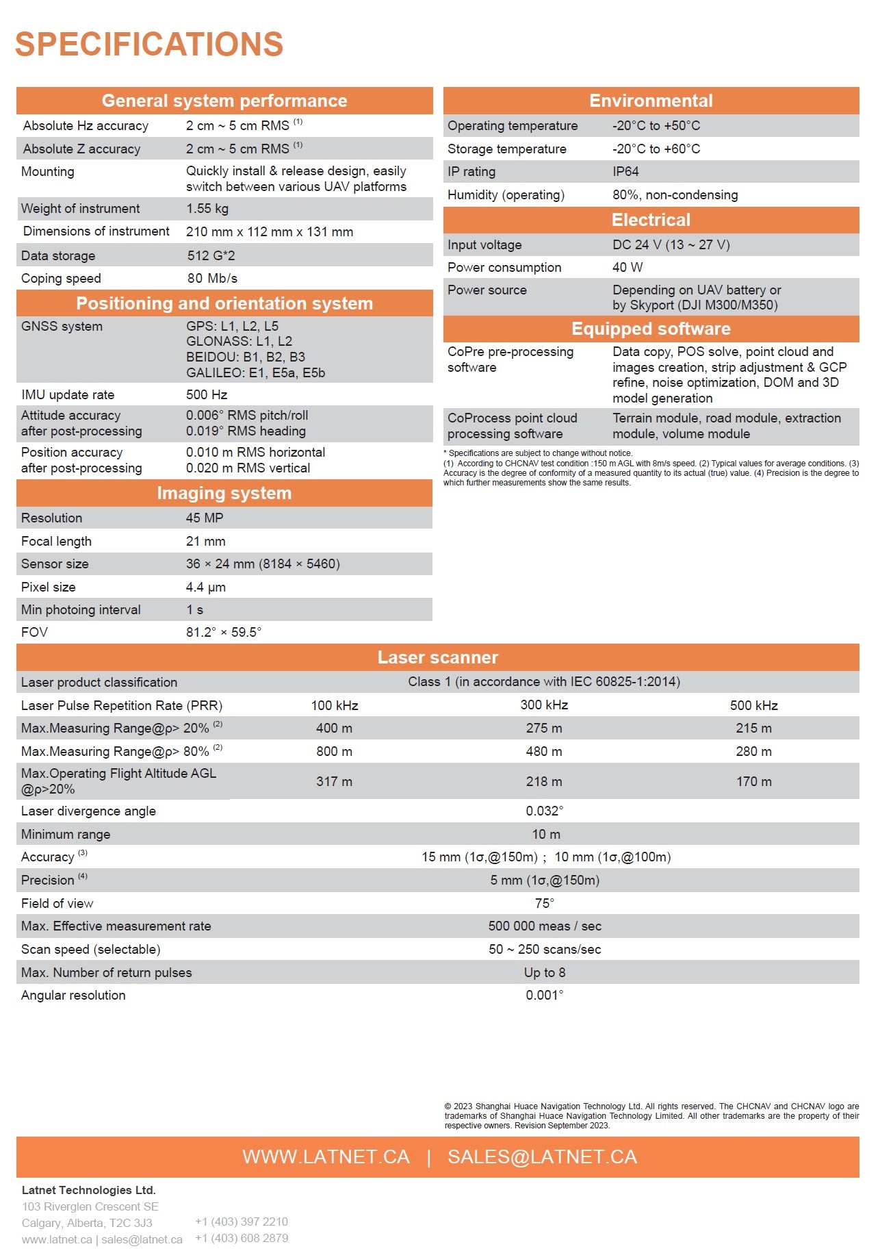
Technical Specification
CHCNAV AlphaAir 10 (AA10) Lidar
Sample Data – CHCNAV AA10
This aerial dataset was captured using the CHCNAV AlphaAir 10 (AA10) — a high-performance LiDAR scanner capable of recording up to
8 returns per pulse. Designed for forestry, terrain, and vegetation mapping, the AA10 sets a new standard in its weight class for
penetration through dense canopy and fine feature detection.
In this sample, you can clearly distinguish individual tree stumps and trunks, making it ideal for biomass analysis, tree segmentation, and forestry inventory applications.
The unmatched return density ensures nothing is missed — even in the most cluttered or occluded environments.
Note. To explore the dataset in detail: Double-click to zoom in; Use the scroll wheel to zoom in/out; Right-click and drag to pan across the scene;