


CHCNAV Apache 6 Multibeam Hydrographic Survey USV
CHCNAV Apache 6 Multibeam Bathymetric Surveys USV
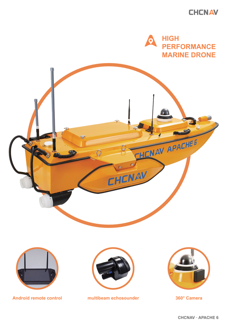
CHCNAV Apache 6, an advanced Unmanned Surface Vehicle (USV) designed for high-resolution 3D bathymetric surveys, underwater object positioning, offshore construction, and underwater archaeology. This versatile USV is optimized for seamless integration with NORBIT multibeam echosounders, delivering precise and efficient data collection in diverse marine environments.
Key Features:
-
Optimized for NORBIT Multibeam Echosounders: The Apache 6 is specifically designed to integrate with NORBIT iWBMSe, iWBMS, and iWBMSh-STX series multibeam echosounders, ensuring high-end performance for the most demanding hydrographic survey requirements.
-
Lightweight and Portable Design: Constructed from macromolecule polyester carbon fiber and Kevlar fiberglass, the Apache 6 weighs approximately 15 kg without sensors. Its lightweight build allows for easy deployment by two operators, even in remote locations.
-
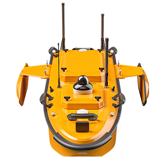
High-Performance Triple-Hulled Vessel: Featuring dual detachable floating bodies, the Apache 6 maintains stability in rapid currents. Removing these floats enables operations in shoals, channels, and shallow rivers without the risk of running aground.
-
Optional Terrestrial Mapping LiDAR Sensor: Enhance your surveys with the optional NORBIT iLiDAR sensor, capable of collecting up to 300,000 points per second with a 30° vertical and 360° horizontal coverage. This feature allows for combined marine and terrestrial 3D surveys in a single pass, streamlining data collection for harbor and river projects.
-
Autonomous and Manual Operation Modes: The Apache 6 supports fully autonomous survey modes powered by CHCNAV's accurate straight-line technology, ensuring precise path following even in challenging current conditions. Additionally, manual control is available via an Android-based remote control with a range of up to 1 km.
Why Choose the CHCNAV Apache 6?
The Apache 6 offers a comprehensive solution for marine survey professionals seeking high-resolution data acquisition in various aquatic environments. Its integration with advanced multibeam echosounders and optional LiDAR sensors provides unparalleled accuracy and efficiency. The lightweight, robust design ensures ease of deployment, while its versatile operational modes cater to both autonomous and manual survey requirements. Whether conducting offshore, coastal, or inland water surveys, the Apache 6 is engineered to meet and exceed the rigorous demands of modern hydrographic surveying.
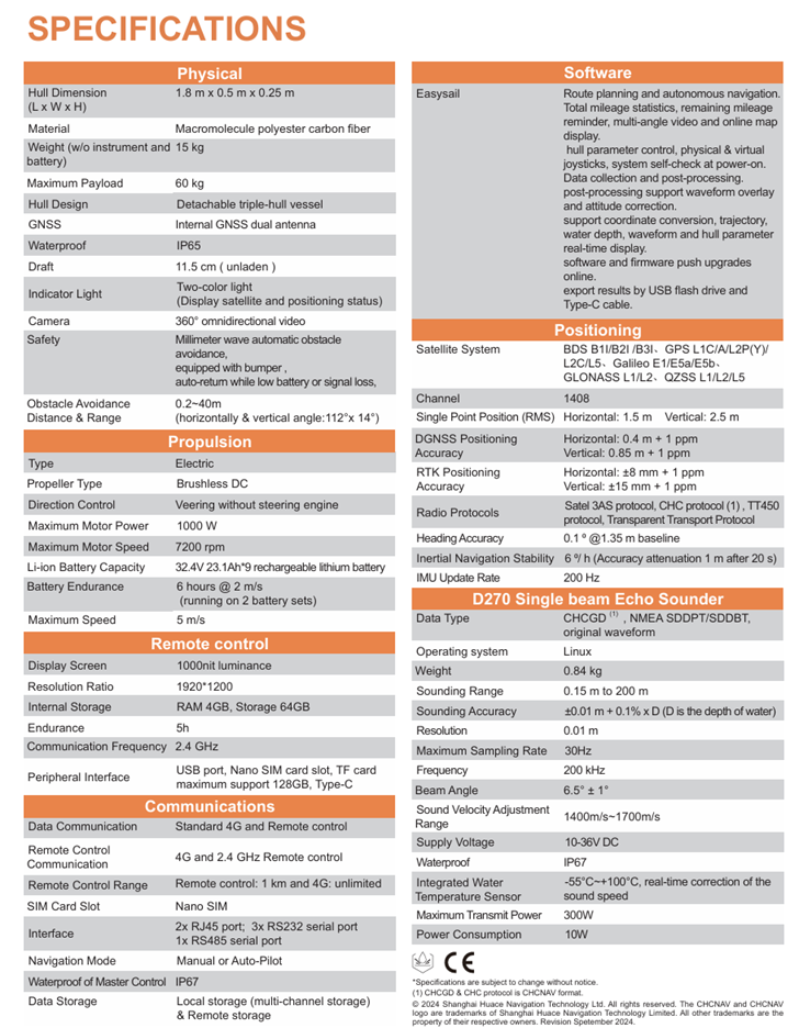
Technical Specifications & Features
CHCNAV Apache 6 USV
Apache 6 USV features
Turnkey multibeam echosounder autonomus USV system
APACHE 6 USV
An innovative, fully integrated solution for 3D bathymetric surveys

