

CHCNAV C30 130MP Oblique Photogrammetry Camera
The C30 is a professional oblique photogrammetry system: five 26 MP cameras capture one nadir and four 45° oblique views in every shot – 130 MP in total.
At 605 g it is among the smallest and lightest industrial oblique cameras, and it mounts on the CHCNAV X500, DJI M300/M350 RTK and fixed-wing UAVs.
Key features
- Multi-angle capture – Five lenses capture nadir and 45° oblique views at once.
- Light and compact – The smallest industrial-grade oblique camera in its class.
- Versatile integration – X500, DJI M300/M350 RTK, P330 Pro and other UAVs via Alphaport.
- Fast data management – 640 GB plug-in module, copy at up to 300 Mb/s.
- Better aerotriangulation – Up to 10% higher AT pass rate with CHCNAV hardware + software.
- Works with LiDAR – CoPre field-to-finish workflow with CHCNAV LiDAR.
At a glance
- 130 MP 5 × 26 MP
- 5 lenses, 25 / 35 mm
- 0.8 s minimum interval
- 605 g 110 × 108 × 85 mm
- 640 GB plug-in storage
- 300 Mb/s data copy speed
Supplied, installed and supported by LATNET in Calgary. Contact us for pricing.
- Authorized CHCNAV dealer in Canada
- Setup, training & local support from our Calgary geomatics team
- Shipped across Canada from Calgary
- See it before you buy – live demo available
Technical Specifications & Features
CHCNAV C30 Aerial Oblique Camera System
CHCNAV C30 – 130 MP five-lens oblique camera for 3D models
The C30 is a professional oblique photogrammetry system: five 26 MP cameras capture one nadir and four 45° oblique views in every shot – 130 MP in total.
At 605 g it is among the smallest and lightest industrial oblique cameras, and it mounts on the CHCNAV X500, DJI M300/M350 RTK and fixed-wing UAVs.

Complete 3D reality capture
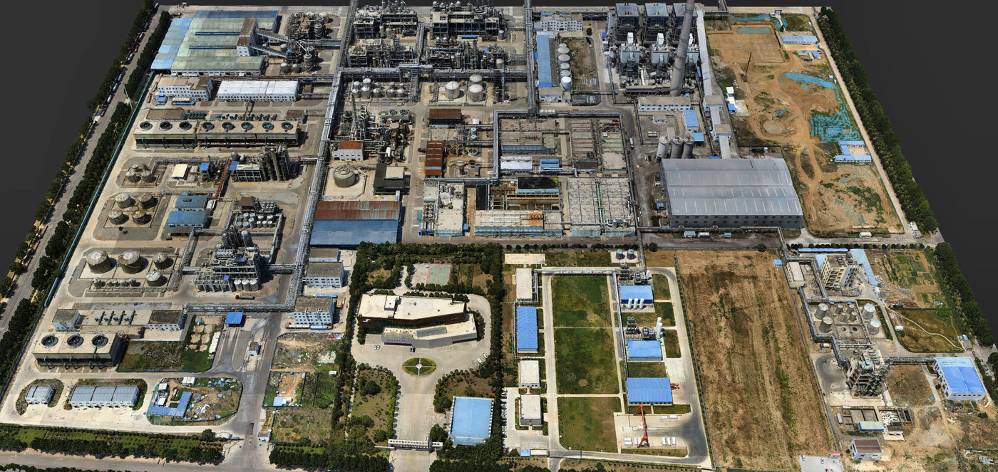
Oblique imagery shows building sides and structures that nadir photos miss, producing realistic 3D meshes for urban planning, inspections and digital twins. The C30 can fly independently on RTK drones or be mounted on CHCNAV AlphaUni LiDAR, and CoPre handles copy, aerotriangulation and modelling.
Why choose the C30
Multi-angle capture
Five lenses capture nadir and 45° oblique views at once.
Light and compact
The smallest industrial-grade oblique camera in its class.
Versatile integration
X500, DJI M300/M350 RTK, P330 Pro and other UAVs via Alphaport.
Fast data management
640 GB plug-in module, copy at up to 300 Mb/s.
Better aerotriangulation
Up to 10% higher AT pass rate with CHCNAV hardware + software.
Works with LiDAR
CoPre field-to-finish workflow with CHCNAV LiDAR.
Five views in every exposure
A 25 mm nadir lens and four 35 mm lenses at 45° capture 6252 × 4168 px each, giving the coverage needed for detailed 3D models and complex mapping projects with fewer flight lines.


Fits the X500, DJI and fixed-wing UAVs
The Alphaport quick-release interface carries power and data and converts to DJI Skyport. Fly the C30 on the CHCNAV X500, a DJI M300/M350 RTK, or long-range fixed-wing VTOLs.


Up to 1.1 km² per multirotor flight
CHCNAV test data on a DJI M300 RTK at 8 m/s (28 min flight): 0.33 km² at 1.5 cm GSD from 100 m, 0.6 km² at 3 cm from 200 m and 1.1 km² at 5 cm from 332 m. On a fixed-wing VTOL at 21 m/s (86 min), a single flight covers 3.2 km² at 3 cm and 5.73 km² at 5 cm GSD.
- 1.5 cm GSD – 100 m AGL – 0.33 km²
- 3 cm GSD – 200 m AGL – 0.6 km² (3.2 km² fixed-wing)
- 5 cm GSD – 332 m AGL – 1.1 km² (5.73 km² fixed-wing)


640 GB plug-in module, 300 Mb/s
All five cameras write to one external storage module (5 × 128 GB). Pull it out and copy straight to your computer at up to 300 Mb/s – no waiting on the drone.
Compare CHCNAV aerial mapping cameras
Two full-frame nadir cameras and a five-lens oblique system – pick by deliverable, drone and workflow.
| C5 | C504 | C30 | |
|---|---|---|---|
| Type | Orthographic (nadir) | Orthographic on 3-axis gimbal | Oblique, 5 lenses |
| Resolution | 45 MP full frame | 45 MP full frame | 130 MP (5 × 26 MP) |
| Sensor | 36 × 24 mm, 4.4 µm | 36 × 24 mm, 4.4 µm | 23.5 × 15.7 mm, 3.76 µm |
| Lens | 35 mm, 54.3° × 37.8° | 40 mm (56 mm option) | 25 mm nadir / 35 mm oblique at 45° |
| Weight | 290 g | 280 g (650 g with gimbal) | 605 g |
| Storage | 256 GB internal, 80 Mb/s | 512 GB | 640 GB plug-in module, 300 Mb/s |
| Mount | Alphaport / DJI Skyport, on AlphaUni LiDAR | CHCNAV X500 gimbal interface | Alphaport / DJI Skyport, on AlphaUni LiDAR |
| Best for | Orthophotos, colour for LiDAR | X500 2D/3D mapping, high-rise | 3D city models, facades |
| C5 | C504 | C30 |
Where the C30 works

Urban planning and 3D cities
Realistic meshes and digital twins.

Road network planning
Corridors in full 3D.

Asset inspection
See facades and structures from every side.

Power lines and solar farms
Context for design and maintenance.
CHCNAV C30 technical specifications
| Lenses | 5 |
|---|---|
| Effective pixels | 130 MP (26 MP × 5) |
| Sensor | 23.5 × 15.7 mm per camera |
| Pixel size | 3.76 µm |
| Image size | 6252 × 4168 px (3:2) |
| Focal length | 25 mm (nadir) / 35 mm (oblique) |
| Lens angle | 90° / 45° |
| Aperture | F5.6 |
| Shutter speed | 1/50 – 1/2000 s |
| ISO | 100 – 3200 |
| Minimum interval | 0.8 s |
| Shutter life | 200,000 exposures |
| Dimensions | 110 × 108 × 85 mm (4.33 × 4.25 × 3.35 in) |
|---|---|
| Weight | 605 g with transfer interface |
| Storage | External unified storage module, 640 GB (5 × 128 GB) |
| Data copy speed | 300 Mb/s |
| Power | 25 W, 12–27 V |
| Operating temperature | –20 °C to +50 °C |
| Storage temperature | –20 °C to +60 °C |
| Mounting | Alphaport quick-release; converts to DJI Skyport |
|---|---|
| Platforms | CHCNAV X500, P330 Pro, DJI M300/M350 RTK, fixed-wing and rotor UAVs, AlphaUni LiDAR |
| Software | CoPre – copy, aerotriangulation and modelling |
C30 FAQ
Why use an oblique camera?
Oblique views capture building facades and vertical structures, producing complete, realistic 3D models that nadir-only imagery cannot.
How much area can I cover?
CHCNAV measured 0.33–1.1 km² per 28-minute DJI M300 flight at 1.5–5 cm GSD, and up to 5.73 km² per 86-minute fixed-wing flight at 5 cm GSD.
Is it useful for construction monitoring?
Yes – repeated oblique flights give 3D progress models, inspections and volumes for site management.
How do I get the data off?
Remove the 640 GB storage module and copy at up to 300 Mb/s.
C30 or C5?
The C30 is for 3D models and facades; the C5 is lighter and best for orthophotos and colourising LiDAR.
Get the C30 from LATNET
Buy or rent the C30 with a drone, plus training and processing support from our Calgary team.
Request a quoteAll mapping cameras