CHCNAV i89 Visual IMU-RTK GNSS Receiver
CHCNAV i89 – Compact & Powerful Visual IMU-RTK GNSS Receiver
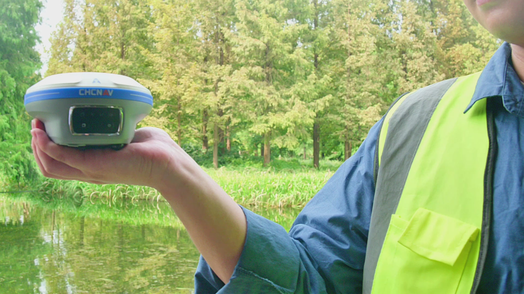
The CHCNAV i89 GNSS Receiver is a compact, high-precision RTK system, designed for surveying, mapping, and engineering applications. Combining advanced GNSS, IMU, and dual-camera visual surveying, the i89 ensures fast, accurate, and reliable measurements in challenging environments. With Auto-IMU tilt compensation, video-photogrammetry, and AR-based stakeout, it streamlines workflows and improves efficiency for professionals in the field.
Key Features:
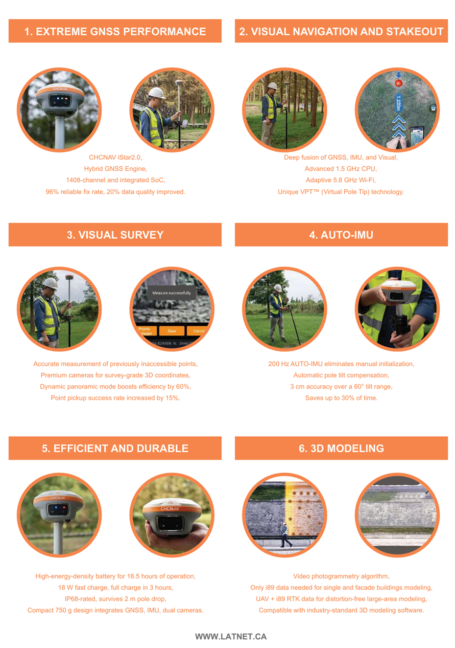
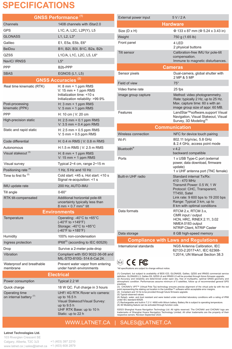
✔ High-Precision GNSS Performance – Equipped with 1408 channels and CHCNAV’s iStar2.0 GNSS technology, the i89 delivers survey-grade RTK accuracy, even in signal-obstructed or high-ionospheric activity areas.
✔ 3D Visual Surveying & Stakeout – The dual-camera system enables real-time visual navigation, allowing surveyors to extract precise 3D coordinates from video. This technology simplifies measurements in hard-to-reach, obstructed, or hazardous locations.
✔ Auto-IMU for Fast & Reliable Operation – The 200 Hz automatic IMU tilt compensation eliminates manual initialization, enabling accurate measurements even with a pole tilt of up to 60 degrees. This boosts efficiency and reduces fieldwork time by up to 30%.
✔ Augmented Reality (AR) Navigation & Stakeout – AR-based stakeout with Virtual Pole Tip™ (VPT™) technology provides real-time visualization of points, increasing productivity and cutting operator workload by 50%, even for less experienced users.
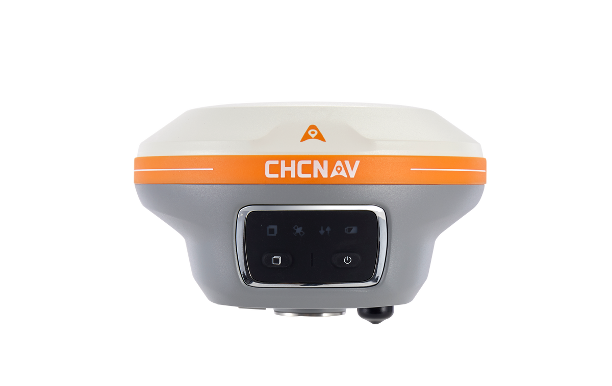
✔ Lightweight & Durable for Field Use – Weighing just 750g, the i89 is compact and easy to carry, while its IP68-rated housing ensures rugged durability against dust, water, and impact.
✔ Extended Battery Life & Smart Charging – With up to 16.5 hours of continuous operation and fast charging in just 3 hours, the i89 guarantees uninterrupted field performance.
Why Choose the CHCNAV i89?
The i89 GNSS Receiver is a powerful yet pocket-sized solution for surveyors, engineers, and mapping professionals who need high-precision positioning with advanced visual surveying capabilities. Its compact design, automated IMU, video-based measurement, and AR stakeout make it one of the most efficient and versatile GNSS receivers available. Whether used for site layouts, topographic surveys, infrastructure projects, or 3D modeling, the i89 delivers speed, accuracy, and reliability in every project.
Upgrade your surveying experience with the CHCNAV i89 – the future of compact GNSS technology.
Technical Specifications & Features
CHCNAV i89 Pocket Sized Visual GNSS Receiver
i89 features
Compact GNSS RTK that integrates the latest GNSS, IMU, and dual-camera video-photogrammetry technologies
Visual Stakeout Made Easy
With immersive 3D visual navigation and real-time guidance, the CHCNAV i89 transforms stakeout workflows. Follow on-screen arrows, measure from photos, and stake points with centimeter-level accuracy—even in obstructed or GNSS-limited zones. Boost field efficiency by up to 50% with intuitive, camera-assisted stakeout powered by advanced IMU and visual technologies.

Survey What GNSS Can’t See
The CHCNAV i89 Visual Survey feature enables you to measure points directly from video frames using its premium dual-camera system. Capture accurate 3D coordinates in GNSS-denied areas such as under bridges, building corners, or densely forested sites. Perfect for hazardous, obstructed, or hard-to-reach locations, visual survey ensures no detail is left behind.

Smarter 3D Modeling with i89 GNSS (as an option)
The CHCNAV i89 enhances 3D modeling workflows by combining high-precision GNSS data with aerial surveys for joint reconstruction. Easily integrate RTK ground control with UAV imagery to reduce distortion, fill gaps, and correct occlusions—especially in complex environments. Compatible with popular tools like Agisoft Metashape, the i89 lets you optimize your models without additional software costs.

Superior GNSS Performance in Any Terrain
Powered by CHCNAV’s advanced iStar RF‑SoC engine, the i89 delivers exceptional positioning reliability even in challenging environments. With 1408 GNSS channels, hybrid constellation tracking, and narrowband interference rejection, it offers a 15% performance boost and 20% better signal stability in urban canyons, under tree cover, and near interference sources.

i89 POCKET-SIZED VISUAL IMU-RTK GNSS
EXTREME GNSS PERFORMANCE
VISUAL POWER ON TOP