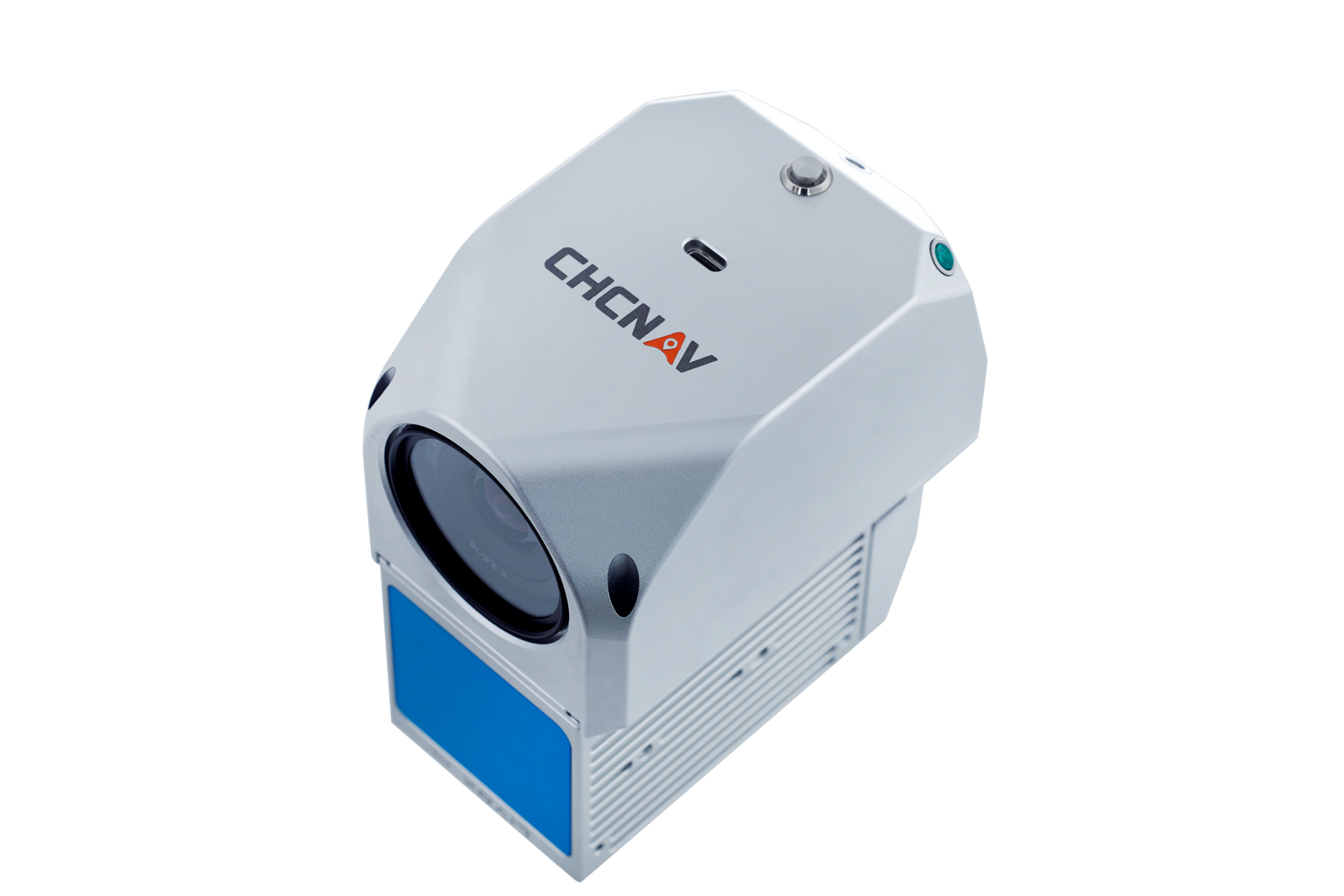
CHCNAV AlphaAir 450 UAV LiDAR System for Affordable Aerial Mapping
CHCNAV AlphaAir 450 (AA450) – The Most Cost-Effective UAV LiDAR Scanner
Lightweight, Powerful, and Subscription-Free
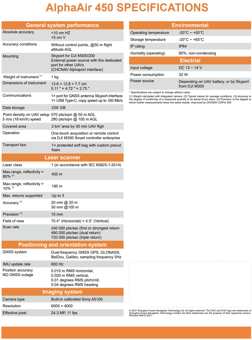
The CHCNAV AlphaAir 450 (AA450) sets a new standard for affordable UAV LiDAR mapping. It combines excellent scanning performance, a built-in 26 MP camera, and a high-quality navigation system into a lightweight, all-in-one device. Weighing only 0.95 kg, the AA450 extends UAV flight times, allowing for maximum coverage per mission. Best of all, it includes CoPre perpetual software with no ongoing subscription fees. This makes it a smart long-term investment for both professionals and newcomers.
Why Choose the AA450?
-
Unbeatable Cost-Performance - No subscription fees with CoPre & CoProcess software included, reducing long-term expenses.
-
Extended Flight Time & Efficiency - Weighing just 0.95 kg, the AA450 enables longer flights, covering up to 2 km² per mission.
-
High-Quality LiDAR & Imaging - Captures 720,000 points per second with a 450 m range, paired with a 26 MP integrated camera for clear imagery.
-
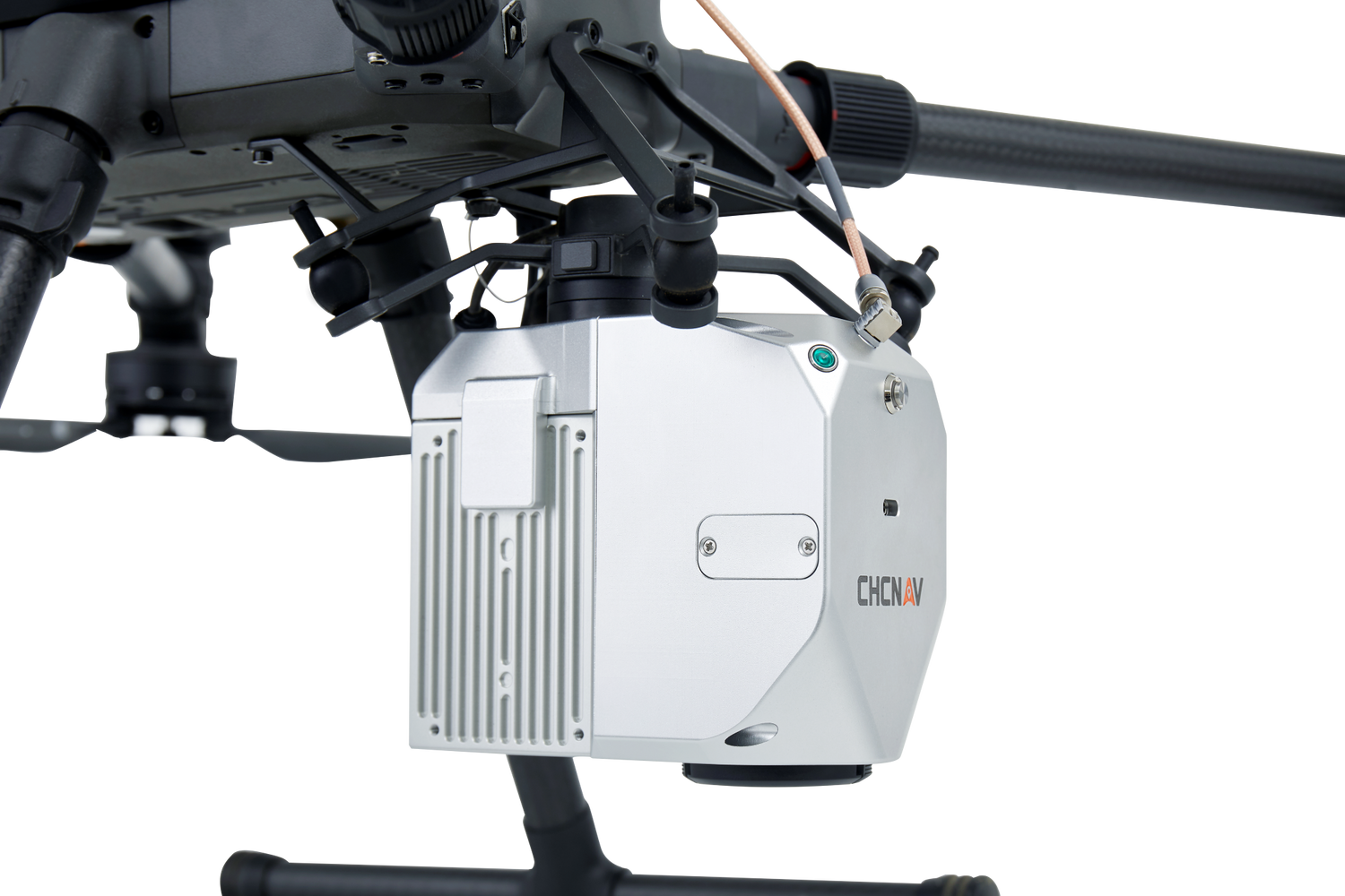
Seamless UAV Integration - Compatible with CHCNAV X500, DJI M300/M350, CHCNAV BB4, VTOLs, and multi-rotor UAVs, ensuring easy installation.
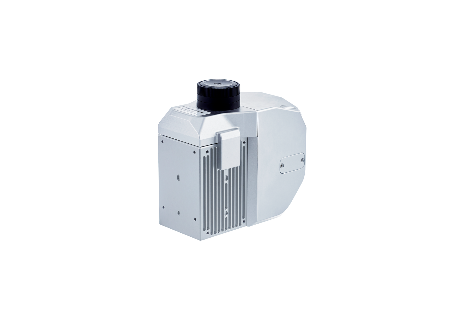
- Rugged & Reliable - Built for tough field conditions (IP64-rated), with quick data transfer via USB-C for smooth post-processing.
Whether you’re inspecting powerlines, conducting topographic surveys, mapping forests, or responding to emergencies, the CHCNAV AA450 delivers top-quality LiDAR performance at a low cost with no hidden fees.
Upgrade to smarter, more affordable UAV LiDAR mapping with the CHCNAV AlphaAir 450.
Technical Specification
Alpha Air 450
AA450 features
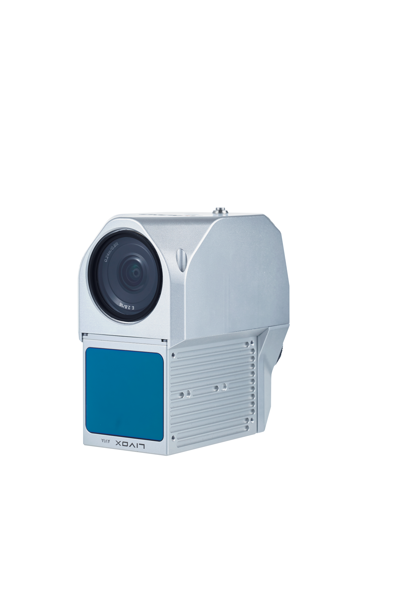
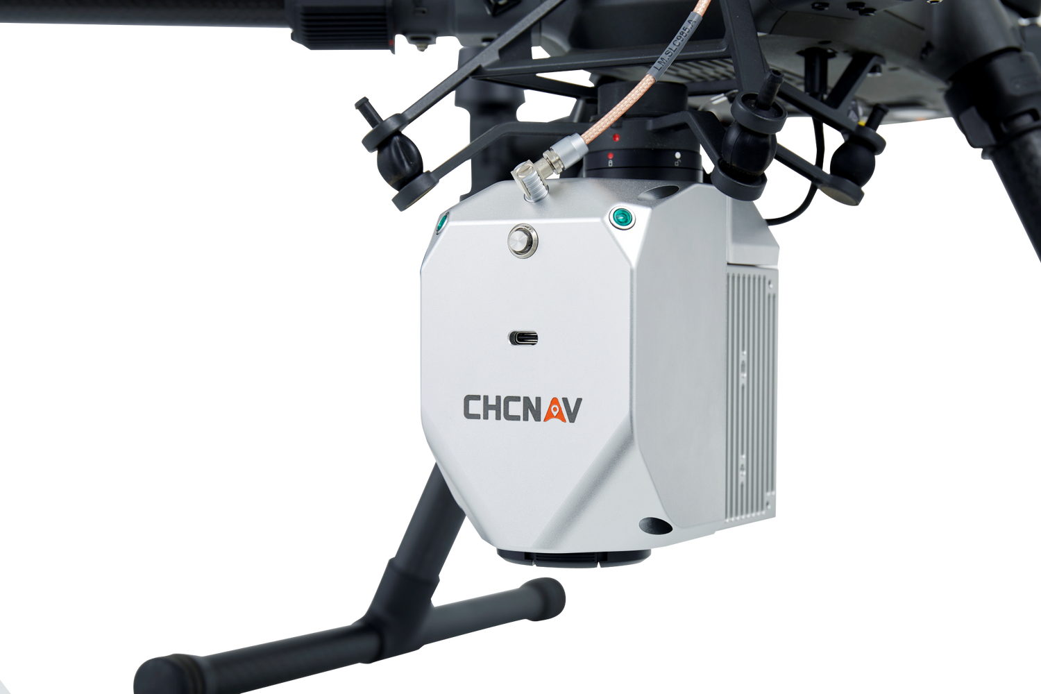
Airborne LiDAR system with built-in IMU, GNSS, 3Dscanner and camera

AlphaAir 450 LiDAR
Airborne LiDAR system with built-in IMU, GNSS, 3D scanner and camera.


Sample Data – CHCNAV AlphaAir 450 (AA450)
See the power of compact LiDAR in action. The AlphaAir 450 (AA450) is CHCNAV’s lightweight, budget-friendly UAV LiDAR system
— perfect for corridor mapping, road inspection, and powerline surveys. Despite its size, the AA450 delivers exceptional accuracy and dense point clouds, even on complex linear projects.
In this example, the AA450 maps a long corridor with seamless consistency. Designed for integration on multi-rotor drones, it's the ideal tool when agility, affordability, and quality all matter.
A true “small but mighty” performer in the professional LiDAR space.
Note. To explore the dataset in detail: Double-click to zoom in; Use the scroll wheel to zoom in/out; Right-click and drag to pan across the scene;