
CHCNAV CoPre LiDAR Processing Software
CHCNAV CoPre - LiDAR Processing Software
Product Overview: CoPre is a powerful software ecosystem developed by CHCNAV, designed to quickly and efficiently process mobile geospatial mapping data. Featuring accurate trajectory processing, point cloud and image georeferencing, colorization, filtering, and digital ortho model (DOM) generation, CoPre significantly improves post-processing accuracy. With a simple and intuitive user interface, CoPre allows geospatial professionals to export point clouds and image files without the need for third-party software.
Key Features:
Comprehensive LiDAR Data Processing
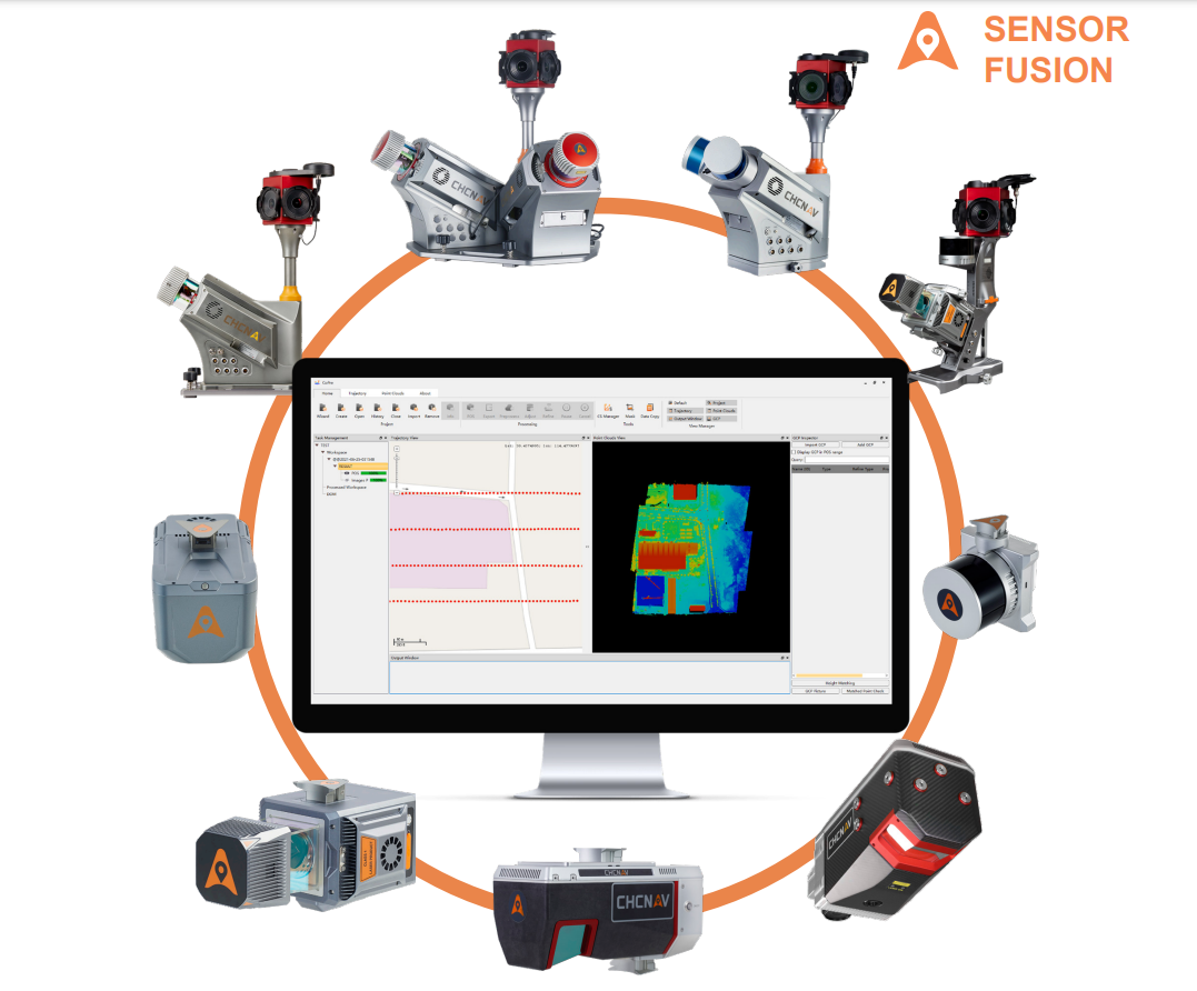
- Wide Support for CHCNAV LiDARs: CoPre supports raw data processing from all CHCNAV LiDAR systems, including the compact AlphaAir 45, AlphaAir 10, vehicle-mounted AlphaUni 20 and other.
Advanced Data Quality
- Enhanced Calibration and Optimization: CoPre features advanced processing modes to handle multiple point clouds and improve relative accuracy through efficient strip adjustment algorithms. Ground control points (GCPs) can be used to further enhance absolute accuracy, resulting in a point cloud thickness that is 30% less than similar products.
Efficient Data Analysis
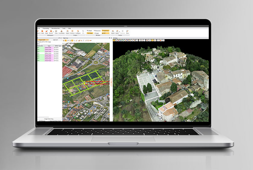
- Visualization and Colorization: CoPre includes powerful options for data visualization and colorization, supporting massive data sets. It offers automatic trajectory slicing, stratification checking, and elevation accuracy verification, providing multiple accuracy reports for quality control.
Automated Processing
- User-Friendly Interface: CoPre supports automated point cloud processing, image georeferencing, point cloud colorization, depth maps, and results output with a single click. Built on significant expertise in mobile mapping data collection, CoPre ensures high efficiency in data processing.
Comprehensive Pre-Processing Workflow
- Trajectory Generation: Powered by CHCNAV's accurate algorithm, CoPre processes captured raw data, including trajectory (POS) files, LiDAR data, and RGB images. It allows simultaneous processing of multiple data sets, enhancing workflow efficiency, especially for SLAM-based units.
Advanced Reconstruction Module
- DOM Generation & Modeling: CoPre supports aerial triangulation processes, exporting final digital orthophoto maps and 3D mesh models without the need for additional software. It combines photos and point clouds to quickly export high-efficiency orthophotos or 3D models for on-site checks.
System Features:
- Post-Processing Algorithms: PP, PPK, PPP
- Online Maps: Selectable (OSM, Bing, Google, WMS, WMTS)
- Geodetic Tools: Coordinate system manager, GNSS antenna manager, ephemeris download, data quality check, and more
- Integration: Support for RTK projects, UAV PPK, and USV PPK
- Data Import/Export: Multiple formats supported, including RINEX, CRINEX, KML, SHP, DXF, HTML, CSV, PDF, RAW, ASC, TXT
- Embedded Manual: Comprehensive electronic user manual for easy reference
Why Choose CHCNAV CoPre?
CHCNAV CoPre offers an unparalleled combination of powerful data processing capabilities, intuitive workflow, and comprehensive geodetic tools, making it the ultimate LiDAR processing solution for a wide range of applications. From geodetic and surveying to UAV and road construction, CoPre ensures high accuracy and efficiency in LiDAR data processing.
Enhance your LiDAR data processing capabilities with CHCNAV CoPre – the advanced software solution for high-accuracy geospatial mapping and modeling.
CoPre features
An advanced, user-friendly 3D laser scanning data processing software.
CoPre LiDAR Processing Software
A powerful software ecosystem that enables users to quickly and efficiently process mobile geospatial mapping data.

