i93 Advanced RTK Receiver with Visual Surveying
CHCNAV i93 – Advanced Visual IMU-RTK GNSS Receiver
The CHCNAV i93 GNSS Receiver is a cutting-edge visual IMU-RTK surveying and engineering solution, designed to enhance precision, efficiency, and ease of use. By integrating advanced GNSS, IMU, and dual-camera technologies, the i93 revolutionizes traditional surveying workflows. With 3D visual stakeout, video-photogrammetry, and automated IMU calibration, it allows surveyors to achieve faster, more accurate results in even the most challenging environments.
Key Features:
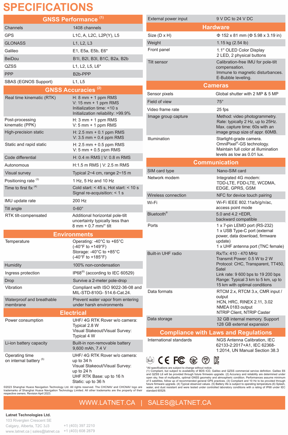
✔ High-Precision GNSS Performance – Utilizing multi-constellation tracking and CHCNAV's iStar GNSS RTK algorithm, the i93 ensures consistent, survey-grade accuracy even in areas with limited satellite visibility. Its hybrid engine improves positioning performance, delivering high-quality RTK data for construction sites, infrastructure projects, and geospatial applications.
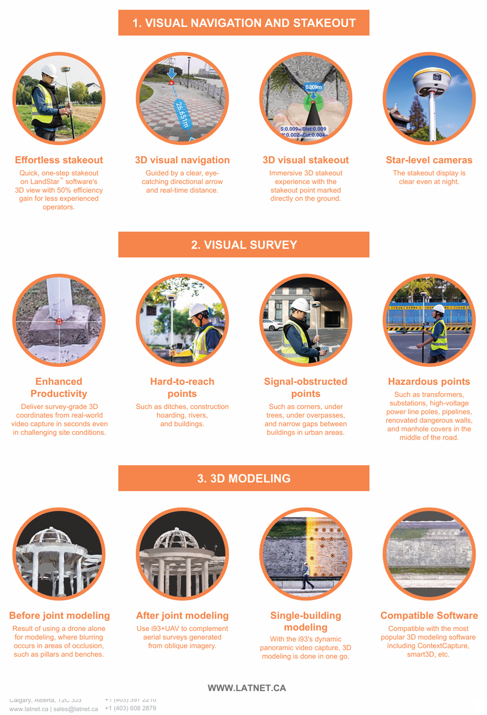
✔ 3D Visual Survey & Stakeout – The dual-camera system enables real-time visual navigation, allowing operators to see and stake out points more efficiently. The intuitive LandStar software provides a clear, 3D visual experience with a directional arrow and distance indicators, simplifying stakeout and increasing productivity.
✔ Video-Photogrammetry for Hard-to-Reach Points – With video-based point measurement, surveyors can capture precise 3D coordinates from video footage, making it possible to survey hazardous, obstructed, or otherwise inaccessible locations. This feature eliminates the need for manual access, improving both safety and efficiency.
✔ Auto-IMU for Seamless Operation – The 200 Hz automatic IMU tilt compensation ensures instant initialization with no manual calibration required. Operators can measure and stake out with high accuracy even when tilting the pole up to 60 degrees, improving speed and flexibility in the field.
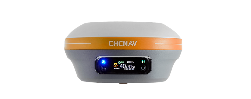
✔ Long-Lasting Performance & Rugged Build – Designed for demanding field conditions, the i93 is housed in a shock-resistant magnesium alloy body with IP67 dust and water protection. A long-lasting battery provides up to 34 hours of continuous operation, eliminating downtime.
✔ Reliable Connectivity & Versatile Applications – Equipped with Wi-Fi, Bluetooth, NFC, 4G LTE, and UHF modems, the i93 supports seamless communication with controllers and cloud-based workflows. Whether working as an RTK network rover, base station, or in PPK mode, the i93 adapts to diverse surveying and mapping applications.
Why Choose the CHCNAV i93?
The CHCNAV i93 GNSS Receiver is a game-changer for surveyors, engineers, and construction professionals, combining next-generation technology with ease of use and durability. Its visual navigation, high-precision GNSS, automated IMU, and photogrammetry capabilities set it apart as one of the most versatile and efficient RTK receivers available. Whether for site layouts, topographic surveys, infrastructure projects, or 3D modeling, the i93 delivers fast, accurate, and reliable results every time.
Upgrade your surveying experience with the CHCNAV i93 – the future of high-precision GNSS technology.
Technical Specifications & Features
CHCNAV i93 Visual GNSS Receiver
i93 Features
GNSS RTK that integrates the latest GNSS, IMU, and dual-camera video-photogrammetry technologies
Visual Stakeout Made Easy
With immersive 3D visual navigation and real-time guidance, the CHCNAV i93 transforms stakeout workflows. Follow on-screen arrows, measure from photos, and stake points with centimeter-level accuracy—even in obstructed or GNSS-limited zones. Boost field efficiency by up to 50% with intuitive, camera-assisted stakeout powered by advanced IMU and visual technologies.

Survey What GNSS Can’t See
The CHCNAV i93 Visual Survey feature enables you to measure points directly from video frames using its premium dual-camera system. Capture accurate 3D coordinates in GNSS-denied areas such as under bridges, building corners, or densely forested sites. Perfect for hazardous, obstructed, or hard-to-reach locations, visual survey ensures no detail is left behind.

Smarter 3D Modeling with i93 GNSS
The CHCNAV i93 enhances 3D modeling workflows by combining high-precision GNSS data with aerial surveys for joint reconstruction. Easily integrate RTK ground control with UAV imagery to reduce distortion, fill gaps, and correct occlusions—especially in complex environments. Compatible with popular tools like Agisoft Metashape, the i93 lets you optimize your models without additional software costs.

Superior GNSS Performance in Any Terrain
Powered by CHCNAV’s advanced iStar RF‑SoC engine, the i93 delivers exceptional positioning reliability even in challenging environments. With 1408 GNSS channels, hybrid constellation tracking, and narrowband interference rejection, it offers a 15% performance boost and 20% better signal stability in urban canyons, under tree cover, and near interference sources.

i93 VISUAL IMU-RTK GNSS
Versatile, Efficient and
Easy-To-Use Visual IMU-RTK