TrueView GO 132S
TrueView GO 132S is backordered and will ship as soon as it is back in stock.
GeoCue TrueView GO 132S – Superior Handheld SLAM Solution with Enhanced Point Density
Product Overview
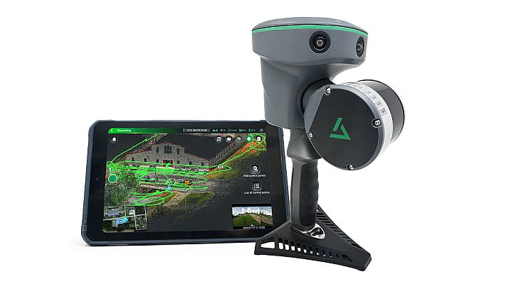
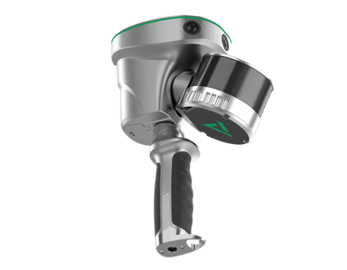
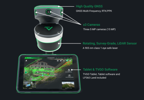
The GeoCue TrueView GO 132S is an advanced handheld mapping solution designed for seamless indoor and outdoor reality capture. Building on the capabilities of its predecessors, the TrueView GO 132S features an upgraded LiDAR system with 32 channels, providing greater point density and higher-definition 3D models. This sophisticated device effortlessly combines GNSS RTK, laser scanning, and SLAM (Simultaneous Localization and Mapping) technologies, allowing users to create highly accurate digital twins of complex environments with ease. With an intuitive “Ready, Set, GO!” workflow, professionals in surveying, construction, BIM, and infrastructure inspection can capture detailed, accurate data wherever they go.
Efficient Workflow with Real-Time Feedback
- Loop-Free Data Collection: By eliminating the need for loop closures, the TrueView GO 132S reduces data collection time while maintaining accuracy, enabling fast, streamlined workflows.
- Real-Time Accuracy Assessment: Equipped with real-time accuracy monitoring, users can check data quality on the spot, allowing for immediate corrections and minimizing the need for post-processing adjustments.
Enhanced Workflow with LP360 Software
- LP360 Processing Suite: Paired with LP360, the TrueView GO 132S enables smooth data processing, classification, and feature extraction. LP360’s advanced modules facilitate point cloud editing, 3D accuracy checks, and high-quality 3D model generation.
Why Choose GeoCue TrueView GO 132S?
The TrueView GO 132S sets a new benchmark in handheld SLAM solutions, with enhanced point density and extended range capabilities. Its combination of GNSS RTK and advanced SLAM technologies ensures accurate, high-resolution 3D mapping in both GNSS-enabled and GNSS-denied environments. Whether used in topographic mapping, building inspections, or creating BIM models, the TrueView GO 132S offers unparalleled accuracy, efficiency, and user-friendly operation, making it a go-to solution for professionals demanding the best in handheld mapping technology.
Step up your 3D mapping with the GeoCue TrueView GO 132S – an advanced, efficient, and powerful tool for precise reality capture.
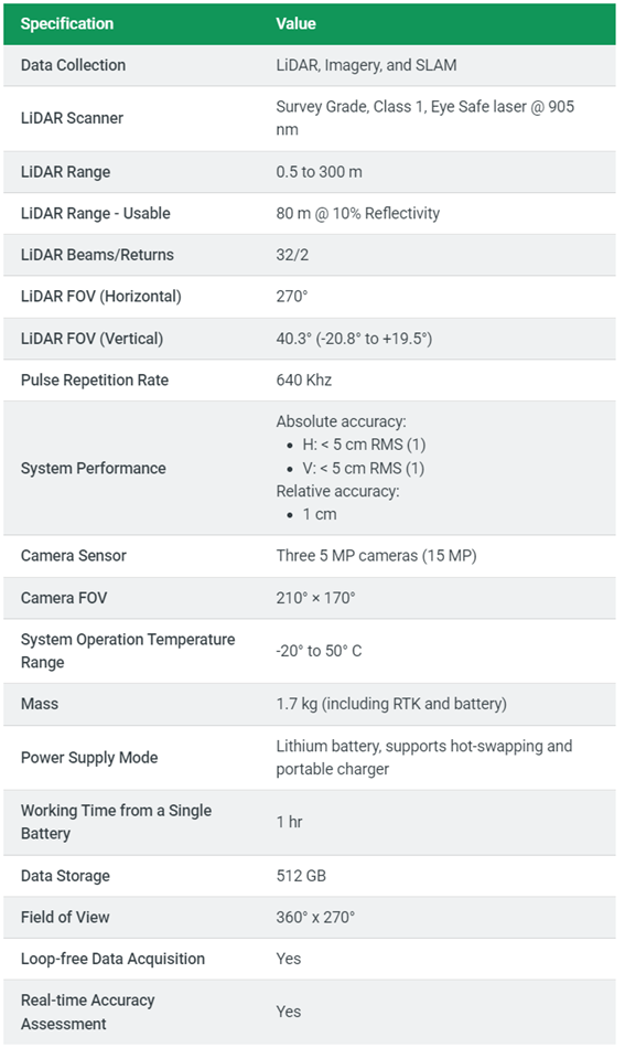
Technical Specification
TrueView Go 132S

Efficient Topographic Survey with the TrueView Go (RS10)
Captured in a single walkthrough using the TrueView Go / CHCNAV RS10, this dataset demonstrates the system’s ability to record full topographic data across floors, walls, ceilings, and building facades—all at once. With no need for return visits or multiple setups, the TV Go / RS10 delivers survey-grade point clouds that support elevation modeling, CAD drawing, and 3D building documentation. Processing is completed seamlessly with GeoCue LP360 or CoPre software for high-quality deliverables. Explore a point cloud of a historical building scanned using the RS10 handheld SLAM system. Ideal for architectural documentation and topographic surveys, the RS10 captures full structural geometry with impressive speed and detail — indoors and out.
Note. To explore the dataset in detail: Double-click to zoom in; Use the scroll wheel to zoom in/out; Right-click and drag to pan across the scene;


