How SLAM LiDAR is Changing the Game
Traditional surveying methods have been essential for mapping and spatial analysis for centuries, evolving from tools like the compass to the theodolite. As technologies advanced, so did the precision and capabilities of these tools. The advent of SLAM (Simultaneous Localization and Mapping) and LiDAR (Light Detection and Ranging) technologies has significantly transformed the way we map environments, offering unprecedented speed and accuracy.
Understanding SLAM LiDAR Technology
SLAM LiDAR combines LiDAR sensors with advanced SLAM algorithms to create dynamic, real-time maps. LiDAR systems measure distances to surrounding objects with laser beams, while SLAM algorithms process this data to simultaneously map the environment and locate the sensor within it. This integration allows SLAM LiDAR systems to generate detailed 3D models, crucial for navigating both familiar and uncharted environments.
Advantages of SLAM LiDAR Over Traditional Methods
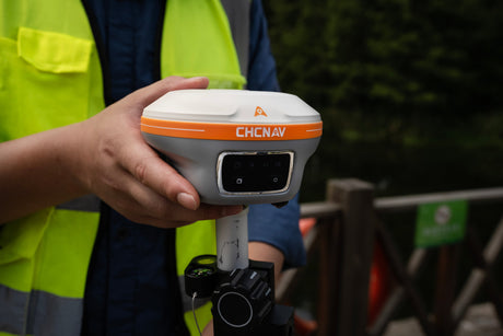
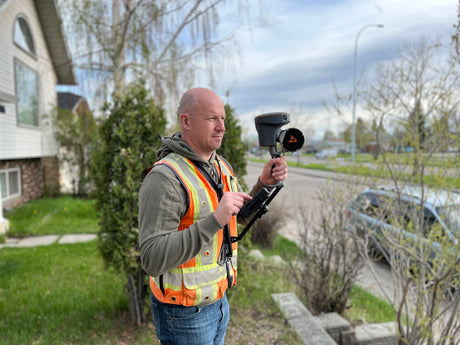
SLAM LiDAR outshines traditional surveying in efficiency and accuracy, significantly reducing the need for repeated site visits and manual data integration. A prime example of innovation in SLAM LiDAR technology is the CHCNAV RS10, which includes built-in GPS receivers, batteries, and operates without cumbersome cables. These features enhance mobility and ease of use, enabling surveyors to conduct operations seamlessly even in GPS-denied environments such as dense forests or indoor settings.
The RS10: A Revolutionary Tool
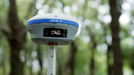
The CHCNAV RS10 integrates a state-of-the-art GNSS Smart Antenna for RTK positioning accuracy, even in challenging environments. Combined with the system’s high-precision LiDAR and three HD cameras, it fuses RTK, laser, and visual SLAM to deliver 5cm absolute measurement accuracy. The RS10 eliminates the need for traditional loop closures, allowing users to freely scan target areas without returning to previous locations, which streamlines field data capture and significantly reduces time spent in the field.
Seamless Transition from Outdoor to Indoor Mapping
One of the standout features of the RS10 is its ability to transition seamlessly from outdoor to indoor environments while maintaining georeferenced data. Its integrated RTK receiver ensures robust positioning outdoors, while SLAM takes over when transitioning indoors – all within a shared coordinate system without requiring additional geo-referencing steps. This capability is crucial for projects that span both environments, such as large infrastructure surveys and complex building interiors.
Adding Control Points for Enhanced Accuracy
For projects requiring even higher accuracy, the RS10 allows the addition of control points to georeference the point cloud. This flexibility ensures that surveyors can achieve the necessary precision for various applications, whether in open fields or confined indoor spaces.
The Future of SLAM LiDAR
With continuous advancements in sensor technology and SLAM algorithms, the potential for SLAM LiDAR is expanding. The CHCNAV RS10 exemplifies such advancements with its integrated design, reducing setup times and operational complexities. As these technologies become more refined and accessible, we can expect wider adoption across various sectors, including disaster management and heritage conservation.
Conclusion
SLAM LiDAR is revolutionizing the field of surveying and mapping with its speed, accuracy, and flexibility. Devices like the CHCNAV RS10 further enhance this technology's impact by simplifying operations and extending its applicability. The future of mapping with SLAM LiDAR promises even greater integration into our efforts to understand and interact with the world around us.


