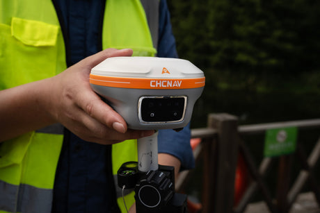
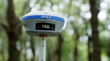
Are All LiDARs Created Equal? Think Again!
How to choose the Best LiDAR.
In the world of precision mapping, LiDAR (light detection and ranging) technology stands out. But beware, not all LiDARs are created equal. When choosing a LiDAR for your needs, digging into the technical specifications is a must—advertisements don't always paint the full picture.
Key Specifications to Consider:
- Accuracy/Precision
Manufacturers will claim their LiDAR system's accuracy, but how it's presented matters. Absolute accuracy is typically double that of standard deviation (SD), a number some use to appear more precise. Also, check the stated accuracy against operational conditions like distance (height) and speed.
- Weight
The weight of your LiDAR system directly affects flight time and productivity; heavier systems result in shorter missions. Ensure to inquire about the total weight, including all necessary equipment.
- Scan Speed
This is about how many points per second the LiDAR captures. Higher scan speeds mean more ground point density and detail. For instance, the AU20 can achieve an effective measurement rate of up to 2,000,000 points per second, significantly enhancing data density and detail.
- Vegetation Penetration (Returns)
LiDAR can generate multiple returns from a single laser pulse. A higher number of returns is advantageous for penetrating dense forest canopies, allowing for a more detailed point cloud. The AA10 captures up to 8 echoes per pulse, while the AU20 supports up to 16 echoes, making them ideal for complex environments.
- Angular Resolution
LiDAR resolution refers to the degree of detail that can be identified in the scanned data. It determines the fineness with which the laser beams sample the surface, resulting in either a dense or sparse point cloud. The AU20 offers an angular resolution of 0.001°, providing extremely fine detail.
- GNSS Specifications
The data collection rate and its support for all four constellations and frequencies (GPS, GLONASS, BEIDOU, GALILEO) can significantly impact performance. Both AA10 and AU20 are equipped with advanced GNSS systems supporting these constellations, ensuring high positional accuracy.
- IMU Update Rate and Accuracy
The IMU (Inertial Measurement Unit) compensates for drone movement by measuring the aircraft's roll, pitch, and yaw. The AA10 and AU20 have high-quality IMUs with update rates of up to 600 Hz, ensuring accurate compensation for drone movement and maintaining high precision in data collection.
- Camera Integration
Does the LiDAR come with a camera, or is it an additional cost? Verify the camera's resolution in megapixels (MP) and sensor size. The AA10 features a 45 MP full-frame camera, providing high-resolution images that complement the LiDAR data. The AU20 can also be equipped with a 45MP CHCNAV C5 Camera or with a third-party camera like 61 MP Sony camera, offering superior image quality and detailed texture mapping.
- Laser Beam Divergence
The laser beam divergence is defined as the angular measure of how the beam diameter increases with the distance from the laser aperture. A smaller beam footprint at your desired flight height results in cleaner, more precise data. Conversely, large divergence can lead to less defined, fuzzier surfaces, wires, and similar features. The AA10 and AU20 have one of the smallest laser beam divergences on the market.
- Compatibility
Can the LiDAR be attached to different UAVs, and is it compatible with most popular UAVs? Both AA10 and AU20 are designed for multi-platform use, making them versatile and easy to integrate with various UAVs. AU20 is a multi platform system that can be integrated on helicopters, airplanes, vehicles, and even backpack mounts for ground-based surveys.
- Software
Inquire whether you need to purchase additional LiDAR data processing software or if essential modules, such as trajectory adjustment and point cloud coloring, are included. The AA10 and AU20 come with CHCNAV’s CoPre and CoProcess (optional) software suites, which streamline post-processing and feature extraction, enhancing efficiency and ease of use.
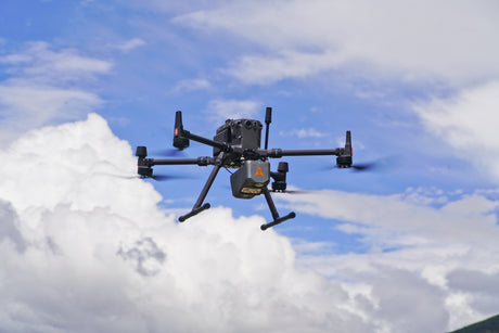
The Best Choices: AA10 and AU20 LiDAR Systems
CHCNAV AlphaAir 10 (AA10)

The AA10 is an advanced aerial surveying solution, seamlessly integrating high-precision LiDAR technology, accurate GNSS positioning, IMU orientation, and an industrial-grade full-frame orthophoto camera. Key features include:
- High Accuracy: Provides 5 mm repeated range accuracy with absolute precision in the range of 2 to 5 cm.
- Enhanced Vegetation Penetration: Capable of capturing up to 8 target echoes, enhancing ground surface detail even in dense vegetation.
- Long-Range Measurements: Capable of measurements up to 800 meters, with rapid scanning at 500,000 points per second.
- Lightweight and Compact Design: Weighing only 1.55 kg, ensuring longer flight times and greater productivity.
- Ruggedness: IP64 rating for reliable performance in various conditions.
- Integrated 45 MP full-frame camera: Allows high accuracy photomap creation and accurate point cloud colorization.
CHCNAV AlphaUni 20 (AU20)

The AU20 is designed for high-end professional use, offering several advanced features:
- Superior Precision: Provides even higher accuracy, making it ideal for complex environments and applications requiring utmost precision.
- Multi-Target Capability: Capable of detecting up to 16 echoes per pulse, significantly improving detail in heavily vegetated areas.
- Higher Data Density: Scanning at even higher speeds and densities, ideal for large-scale projects, with a maximum effective measurement rate of 2,000,000 points per second.
- Versatile Integration: Easily mounted on a wide range of drones, including the CHCNAV BB4 and various third-party UAV platforms. It can also be used on land vehicles or as a backpack-mounted system.
- Lightweight Design: Weighs just 2.82 kg, ensuring ease of use and flexibility in various applications.
- Advanced Imaging: Equipped with a 45 MP full-frame camera, and optionally, a 61 MP Sony camera for superior image quality.
Benefits of the AA10 and AU20 LiDAR Systems:
- Efficiency: Both systems allow for high-efficiency data collection, reducing the number of flights required.
- Cost-Effectiveness: Streamlined workflows and advanced integration with software suites like CoPre and CoProcess enhance post-processing efficiency.
- Reliability: Built for rugged use, these systems ensure reliable performance in diverse environmental conditions.
By choosing the AA10 or AU20, you're not just investing in cutting-edge technology; you're ensuring the highest standards of accuracy, efficiency, and reliability for your aerial surveying needs.