
Canada-Wide Coverage
Ship precision geospatial equipment coast to coast. Local pickup available in Calgary.
Whether you're a survey crew on a one-off corridor job, a construction firm needing RTK GNSS for a single season, or an engineering office evaluating UAV LiDAR before buying — renting from Latnet makes financial and operational sense. Based in Calgary, we ship precision survey gear across Alberta, BC, Saskatchewan, Ontario, and the rest of Canada. Every rental includes direct technical support from our geospatial team — not a call centre.


Fast logistics, genuine technical support, and a credit structure that makes renting a smart step toward ownership — not a dead-end cost.
Most rental companies treat rental fees as sunk cost. We don't. Rent a system, use it on your project, decide to buy — and we apply up to 100% of what you've paid toward the purchase price.
Renting from Latnet is the lowest-risk way to evaluate equipment before committing to a capital purchase. Your team gets real field experience on the actual system, and the cost is recoverable.
Ask About Rental-to-Own* Conditions apply. Credit percentage varies depending on rental duration and equipment. Contact us for details.
All systems are maintained, calibrated, and shipped complete with accessories. Contact us for weekly and monthly pricing.

Autonomous USV for bathymetric surveys, lake and river bed mapping, hydrographic data collection, and volume calculations in Canada. Read our complete bathymetric survey guide →

UAV-mounted aerial LiDAR system for corridor mapping, terrain modelling, forestry inventory, powerline inspection, and large-area 3D surveys in Canada. Not sure which LiDAR is right for your project? →

Rent the AA6D sensor alone — compatible with your own UAV platform for aerial LiDAR mapping, corridor surveys, and 3D terrain capture

Handheld SLAM LiDAR scanner with integrated GNSS RTK for indoor and outdoor 3D mapping — as-built surveys, BIM capture, tunnels, stockpiles, and corridor scanning without tripods or targets

Tactical-grade handheld SLAM LiDAR for indoor and underground 3D mapping — buildings, corridors, stairwells, tunnels, and GNSS-denied environments
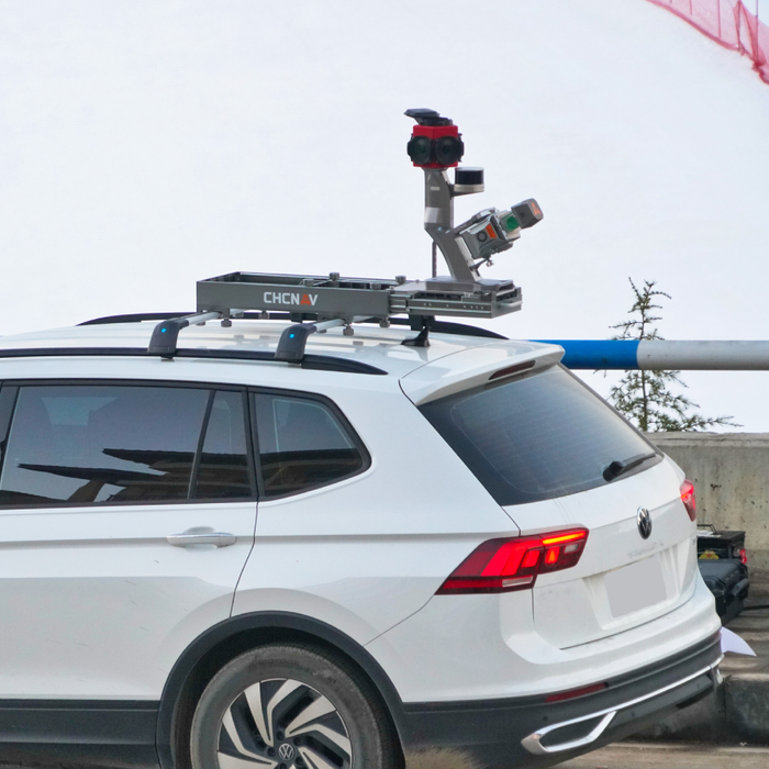
Vehicle-mounted mobile LiDAR mapping system for road and highway corridor surveys, utility and infrastructure mapping, asset inventory, and high-speed large-area 3D data collection

Complete RTK GNSS base-and-rover system for topographic surveys, construction stakeout, boundary surveys, and GIS data collection across Canada. RTK GNSS buyer's guide →
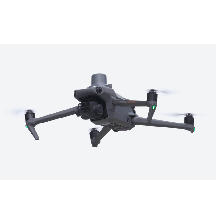
Compact RTK drone for aerial photogrammetry, orthophoto and DSM production, construction site progress monitoring, and volumetric surveys
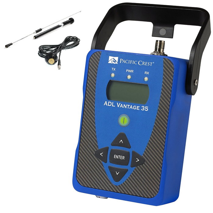
UHF radio base station for delivering RTK corrections in remote areas without cellular coverage — essential for rural and northern survey projects across Alberta and Canada
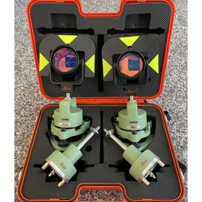
Professional prism and tribrach set for total station traverse surveys, control point establishment, and precise angular and distance measurements
Latnet operates its own CORS base station network covering parts of Alberta. When you rent a GNSS receiver from us, you can connect to our network for RTK corrections via NTRIP — no base station setup required in covered areas. This is a differentiator no other rental supplier in the region can offer.
Tell us your project area when requesting a quote. We'll confirm coverage and include network credentials with your rental kit.
Rental rates vary by system and rental period. We offer weekly and monthly rates — monthly provides better value for longer projects. Contact us with the equipment you need and your project dates and we'll send a quote within a few hours on business days.
Our standard minimum is one week. For project-specific situations, contact us — we can sometimes accommodate shorter windows depending on availability and logistics.
Yes. We ship rental systems across Canada — BC, Saskatchewan, Ontario, Quebec, and beyond. Local pickup is also available at our Calgary location. Shipping costs and timelines are included with your quote.
We dispatch confirmed rental systems within 24 hours. Contact us in the morning and your equipment can ship the same day in most cases. We recommend booking at least a few days ahead when possible to confirm availability.
Yes — up to 100% of paid rental fees may apply toward the purchase of any system in our catalog, depending on rental duration and the equipment involved. The credit applies to any system, not just the one you rented. Talk to us at the time of rental or any point during your rental period — conditions apply.
Yes. Every rental includes direct access to our technical team by phone and email throughout the rental period — field setup guidance, software questions, and workflow troubleshooting. For new operators we can arrange an onboarding call before the system ships.
Yes — and this is a real advantage of renting from us. Latnet operates its own CORS RTK correction network covering parts of Alberta. If your project falls within our coverage area, you can use NTRIP corrections from our network without setting up a base station. We'll confirm coverage and include credentials with your rental.
The renter is fully responsible for any damage, loss, or theft during the rental period. You are required to have adequate insurance coverage for the full replacement value of the rented equipment before it ships. Most clients cover rental equipment under their existing contractor's all-risk or equipment floater policy — confirm with your insurer before your rental starts. Rental terms and liability details are set out in our rental agreement provided at booking.
Tell us what you need and your project dates. We'll confirm availability and pricing the same day.
Call +1 (403) 397-2210 →

