
Rent a complete CHCNAV aerial LiDAR system — sensor, drone and processing software — for corridor mapping, terrain models, forestry and powerline surveys. Shipped across Canada from Calgary within 24 hours.
UAV & Drone LiDAR rental from Latnet
Buying a survey-grade UAV LiDAR system ties up serious capital for equipment you may only fly a few weeks a year. Renting lets you take on the project now, bill it, and decide on ownership later — with the same CHCNAV hardware we sell and support.
Choose the full AA6D + X500 kit if you need an airframe, or rent the AA6D payload on its own to mount on your existing UAV platform. Every LiDAR rental includes CoPre point-cloud processing software, so you can go from flight to classified point cloud without buying a licence.
Available for rent
Weekly rates shown; 3–6 day rentals use the short-term daily rate. Live pricing for your dates is in the booking tool.
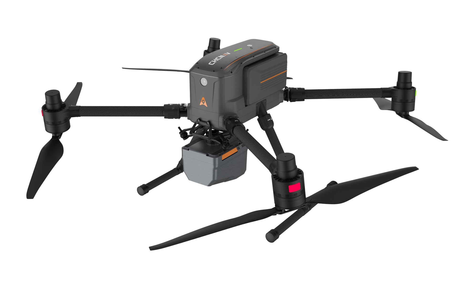
CHCNAV AA6D LiDAR + X500 UAV System rental
Turn-key aerial LiDAR: multirotor airframe, LiDAR payload and processing software in one kit.
- CHCNAV X500 multirotor UAV + remote controller
- CHCNAV AA6D LiDAR payload
- Battery set + charging station
- CoPre processing software (USB dongle)

CHCNAV AA6D LiDAR Payload Only rental
Already own a heavy-lift UAV? Rent just the sensor and processing software.
- CHCNAV AA6D LiDAR payload
- CoPre processing software (USB dongle)
- Optional: X500 UAV, batteries, iBase, i89 rover

DJI Mavic 3 Enterprise RTK rental
Compact RTK drone for photogrammetry, orthophotos, DSMs and stockpile volumes when you don't need LiDAR.
- DJI Mavic 3 Enterprise with RTK module
- 4× flight batteries
- Optional: iBase base station, i89 rover
Typical projects
- Highway, rail and pipeline corridor mapping
- Bare-earth DTMs under vegetation
- Forestry inventory and canopy analysis
- Powerline and utility inspection
- Open-pit, quarry and stockpile surveys
- Large-area topographic mapping
Why rent from Latnet
Frequently asked questions
Do I need a drone pilot certificate to fly the rental?
Yes. In Canada the operator must hold the Transport Canada RPAS pilot certificate appropriate to the operation (Basic or Advanced) and the drone must be registered for the flight. Please confirm your crew's certification before booking.
Is processing software included?
Yes. LiDAR rentals include CoPre on a USB dongle for trajectory processing and point-cloud generation for the length of the rental.
Should I choose UAV LiDAR or photogrammetry?
LiDAR penetrates vegetation and captures wires and thin structures, so it is the right choice for bare-earth models, forestry and powerlines. Photogrammetry from the Mavic 3E is more economical for open sites, orthophotos and stockpiles.
Can I use the Latnet CORS network with the rental?
Yes. Latnet operates its own CORS RTK correction network covering parts of Alberta. If your project is inside coverage, you can use NTRIP corrections without setting up a base station; we confirm coverage and include credentials with the rental.
What is the minimum rental period?
The minimum rental is 3 days. Rentals of 3–6 days use the short-term daily rate; from 7 days the lower weekly rate applies automatically.
Do you ship rental equipment outside Alberta?
Yes. We ship across Canada, including British Columbia, Saskatchewan, Ontario and Quebec. Local pickup is available at our Calgary location, and shipping is included in your quote.
How fast can you dispatch?
Confirmed rentals are dispatched within 24 hours, and morning bookings often ship the same day. Booking a few days ahead is recommended to confirm availability.
Who covers damage during the rental?
The renter is responsible for damage, loss or theft during the rental period and must carry insurance for the full replacement value before the equipment ships. Most clients use their existing contractor's all-risk or equipment floater policy.
Related rentals & guides
Ready to book your UAV & Drone LiDAR rental?
Pick your dates and build your kit in minutes — or call us to talk through the project.