Hydrographic and Bathymetric Surveying Systems: A Complete Guide to USVs, ADCPs, and Multibeam Sonar
From stormwater pond surveys and reservoir sediment studies to river discharge measurement and topo-bathy workflows — a practical guide to modern underwater mapping with CHCNAV survey systems, available through Latnet Technologies in Canada.


Hydrographic and bathymetric surveying is the geospatial discipline of measuring, mapping, and modelling what lies beneath the water surface. It combines precise GNSS positioning, acoustic depth measurement, motion compensation, sound-velocity correction, and structured data processing to produce georeferenced underwater terrain models that hold up to engineering scrutiny.
The term bathymetric surveying refers specifically to measuring and mapping underwater topography — the shape and depth of a water body's floor. Hydrographic surveying is broader: it encompasses bathymetric data collection alongside current profiling with ADCPs, multibeam sonar mapping, environmental monitoring, and the full range of marine and inland water survey operations. When a project involves more than depth lines alone, hydrographic surveying is usually the more accurate description.
Whether you are monitoring a stormwater retention pond, conducting a river discharge study, assessing reservoir capacity loss, estimating sediment accumulation, supporting dredging operations, or building topo-bathy models for hydraulic or environmental analysis, the accuracy of your results depends on how well the full system is configured and deployed. That means the platform, the sensor payload, the GNSS correction strategy, the acquisition software, and the processing workflow working in combination — not any single piece in isolation.
This guide is written for surveyors, engineers, environmental professionals, and project managers who need a practical overview of hydrographic and bathymetric survey methods, how the options compare, and where CHCNAV's Apache USV platforms, hydrographic sensors, ADCPs, and multibeam systems fit into real Canadian projects.
Practical reality: Depth data alone does not produce usable engineering deliverables. Every sounding must be correctly georeferenced, motion-compensated, sound-velocity-corrected, and validated. This is where underspecified or poorly integrated survey systems most often fail.
What Is Hydrographic and Bathymetric Surveying?
Bathymetric surveying is the process of mapping underwater terrain using acoustic sensors tied to precise positioning. Conceptually, it is topographic surveying below the waterline: instead of measuring surface elevations with a total station or aerial drone, the survey system transmits acoustic pulses into the water column, receives the return signal from the bottom, and derives depth from travel time. Each depth measurement is paired with GNSS coordinates, motion data, and correction parameters to produce engineering-grade deliverables.
Hydrographic surveying extends that scope. It includes not only underwater terrain mapping but also water-column current profiling, environmental monitoring, acoustic sonar imagery, and survey support for dredging, marine construction, inland waterways, ports, reservoirs, and shoreline or floodplain management programs.
Common applications for hydrographic and bathymetric surveys in Canada include stormwater pond monitoring, reservoir and dam condition surveys, sediment accumulation studies, dredging support and volume tracking, flood modelling, river cross-section measurement, hydraulic and discharge analysis, environmental impact assessments, and underwater infrastructure inspection such as bridge-pier scour evaluation.
Typical deliverables include depth maps and contour plans, Digital Elevation Models (DEMs), cross-sections and longitudinal profiles, volume and capacity calculations, sediment-thickness interpretation, and — in multibeam workflows — dense 3D point clouds and full-coverage bottom surface models.
Key point: The goal is not simply recording depth. It is producing reliable, georeferenced survey data that can directly support engineering decisions, regulatory submissions, or environmental management plans.

Hydrographic Survey Methods Explained
Single-Beam Echo Sounding (SBES)
Single-beam echo sounders measure depth directly beneath the survey vessel using a single acoustic transducer. It remains the most common, cost-effective, and straightforward method for smaller inland water bodies — and in many municipal, engineering, and stormwater applications, single-beam surveying is still the right tool. It is efficient, reliable, and practical to mobilize.
Single-beam surveys are well suited to ponds, narrow rivers, canals, and smaller reservoirs where line-based depth coverage is sufficient to meet project objectives. They are particularly effective where budgets must stay controlled but the data still needs to support sediment monitoring, capacity calculations, or maintenance planning.
- Best for: stormwater ponds, narrow rivers, canals, and smaller reservoirs
- Affordable, simple to deploy, and highly reliable
- Produces depth soundings along planned survey lines
- Sufficient resolution when line spacing is designed to match the project's accuracy requirements
Alberta context: Many stormwater retention ponds and constructed wetlands across Alberta are shallow, heavily vegetated, and difficult to access. A compact single-beam USV can often complete these surveys faster, more safely, and at lower cost than a conventional manned-boat approach.
Multibeam Echo Sounding (MBES)
Multibeam echo sounding systems emit a fan of acoustic beams in a wide swath, capturing dense bottom coverage across a broad strip during each survey pass. This produces significantly richer terrain information than a single-beam line survey and is the method of choice when full bottom coverage, high-density 3D data, and greater confidence in terrain detail are required.
Multibeam bathymetric surveying is standard practice for larger reservoirs, lakes, dredging projects, infrastructure inspection, shoreline and coastal survey work, and high-specification engineering hydrography.
- Best for large reservoirs, lakes, wider rivers, dredging, and infrastructure surveys
- Provides full or near-full bottom coverage in a single pass
- Generates dense 3D terrain point clouds and surface models
- Supports more reliable feature detection than single-beam line surveys
- Requires accurate IMU motion compensation and sound-velocity correction to produce valid data
A multibeam system can generate a dense, visually convincing dataset quickly — but if roll, pitch, heading, or sound speed are not properly handled, the resulting model will still be inaccurate. Multibeam is not just a sonar head; it is a complete measurement system that depends on well-integrated positioning, motion sensing, and sound-velocity workflows.

ADCP Current Profiling and River Discharge Measurement
ADCPs differ fundamentally from standard bathymetric echosounders. Rather than simply detecting the bottom, an ADCP measures water velocity throughout the water column by analysing the Doppler shift of acoustic backscatter from suspended particles moving with the current. This provides continuous velocity profiles, volumetric discharge data, and hydrological insight that a depth sounder alone cannot produce.
ADCP surveys are used for river discharge measurement, hydraulic modelling inputs, flood analysis, dam operations, environmental flow monitoring, and water resource management. They are especially valuable on projects where the engineer needs to understand not just the channel geometry, but how water is actually moving through that channel at different depths and flow conditions.
ADCP Workflow Types
- River discharge workflows — transect-based streamflow measurement and channel cross-section monitoring
- High-frequency shallow-water workflows — designed for limited depths where blind-zone management is critical
- Mid- and deep-water workflows — suited to broader rivers, reservoirs, and more complex hydrological assessments
Key Advantages of ADCP-Based Surveys
- Simultaneous current velocity profiling and GNSS-referenced position data
- Direct inputs for flood routing and hydraulic models
- Eliminates the need for hazardous manual stream gauging in fast or deep water
- Repeatable, autonomous cross-section transects when integrated with a USV
- Compatible with manned-vessel deployment where site conditions require it

Dual-Frequency Echo Sounding for Sediment Surveys
Dual-frequency echosounders operate simultaneously on two frequencies — typically a higher frequency (such as 200 kHz) for precise bottom detection, and a lower frequency (such as 33 kHz) that penetrates softer bottom sediment. The contrast between the two return signals enables sediment-thickness interpretation, which a standard single-frequency echosounder cannot provide.
This capability matters significantly for reservoir capacity studies, dredging support, storage-loss assessments, and any project where distinguishing the top of accumulated sediment from the underlying hard bottom affects volume estimates and management decisions. A survey that only records surface depth may substantially misrepresent the true storage capacity of a pond or reservoir.
Sound Velocity Profiling (SVP)
Every echosounder derives depth from the travel time of acoustic pulses through water — and the speed of sound in water is not constant. It varies with temperature, salinity, and pressure. Any bathymetric or multibeam survey is therefore dependent on accurate sound-velocity correction.
For inland freshwater surveys, water-temperature stratification alone can introduce meaningful errors without SVP correction. For higher-accuracy work — and particularly for multibeam — dedicated SVP measurement is essential rather than optional.
On the Apache 4 / 4 Pro, the SVP workflow is modular: install the SVP kit, capture the sound-velocity profile, then swap in the HQ-400 multibeam for data acquisition. On the Apache 6, the multibeam and SVP sensors can be installed simultaneously, which supports a more robust continuous-acquisition workflow for higher-specification hydrography.

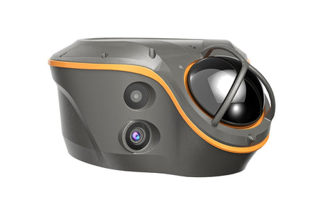
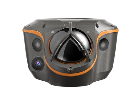
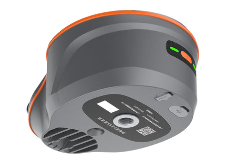
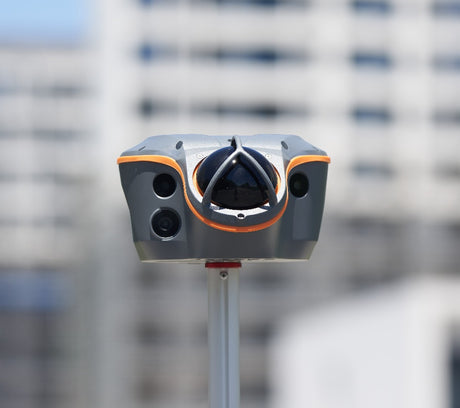
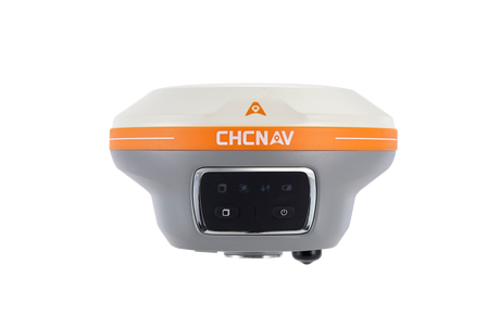
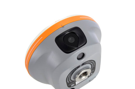
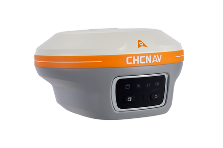
CHCNAV Hydrographic and Bathymetric Survey Systems in Canada
As an authorized CHCNAV dealer in Canada, Latnet Technologies supplies a complete range of CHCNAV hydrographic products — from compact single-beam USVs to multibeam sonar systems, ADCPs, dual-frequency echosounders, and integrated software workflows. The value lies not in the individual products but in how they combine into a complete survey system: platform, sensor payload, GNSS positioning, correction methodology, acquisition software, and processing pipeline working together.
Apache 3
The Apache 3 is affordable compact single-beam USV for straightforward bathymetric surveys on smaller water bodies. It is optimized for portability, fast deployment, and reliable depth measurement where carrying larger sensor payloads or running advanced multibeam workflows is not required.
Apache 3 Pro,
The Apache 3 Pro builds on the compact single-beam form factor with enhanced capability for demanding inland survey environments. It is especially well suited to heavily vegetated ponds, shallow water bodies, and sites where difficult access or aquatic vegetation make compact USV operation a significant operational advantage.
Apache 4 Lite
The Apache 4 Lite is the purpose-built ADCP platform for river flow, discharge measurement, and hydrological monitoring. When the project objective is current profiling and discharge analysis rather than broad-spectrum sensor flexibility, this is the cleaner, more focused choice.
Apache 4 / Apache 4 Pro
The Apache 4 and 4 Pro are versatile mid-range hydrographic platforms configurable for single-beam, ADCP, and multibeam workflows. The HQ-400 multibeam fits these platforms, and where SVP correction is required, the workflow is staged: run the sound-velocity profile first, then swap in the HQ-400 for bathymetric acquisition.
Apache 6
The Apache 6 is CHCNAV's high-specification multibeam USV platform. Its key distinction is the ability to deploy multibeam and SVP sensors simultaneously, making it the stronger choice for continuous high-accuracy multibeam hydrography on larger reservoirs, lakes, and engineering survey sites.
LiDAR Integration on Apache Platforms
Apache platforms are not limited to sonar payloads. LiDAR can be installed to support shoreline mapping, embankment capture, and topo-bathy workflows where the underwater bathymetric model must connect seamlessly with above-water terrain data — a critical requirement for hydraulic modelling, flood mapping, and dam safety assessments.

Hydrographic Sensors for USV and Manned Survey Platforms
The CHCNAV hydrographic sensor range is not limited to USV deployment. Single-beam echosounders, dual-frequency systems, ADCPs, and multibeam systems can all be integrated with conventional survey vessels, workboats, hydrographic trimarans, or fixed monitoring installations — giving Canadian survey teams the flexibility to configure the system around project requirements and existing equipment.
D270
The D270 is CHCNAV's compact single-beam echosounder. It pairs naturally with the Apache 3 and Apache 3 Pro USV platforms and is equally suited to conventional manned-vessel bathymetric workflows where a reliable, field-proven depth sensor is required.
D60
The D60 is the dual-frequency echosounder in the lineup — the appropriate choice when the project requires not only bottom depth, but sediment-layer interpretation and insight into soft-bottom conditions affecting storage capacity or dredging volumes.
D390
The D390 is an integrated single-beam echosounder with onboard hydrographic workflow capability. It is particularly attractive for manned-vessel operators who want a self-contained bathymetric setup without managing separate acquisition hardware.
RS-1200 & RS-600
The RS-1200 and RS-600 are CHCNAV's primary ADCP systems for high-precision current profiling and river discharge measurement. They are the core instruments when the project scope includes hydrology, streamflow analysis, or hydraulic model inputs alongside or instead of standard bathymetric depth mapping.
RS3600D
The RS3600D is CHCNAV's dual-frequency ADCP, designed for specialized hydrometric workflows and shallow-water current profiling applications where standard single-frequency ADCP performance is insufficient.
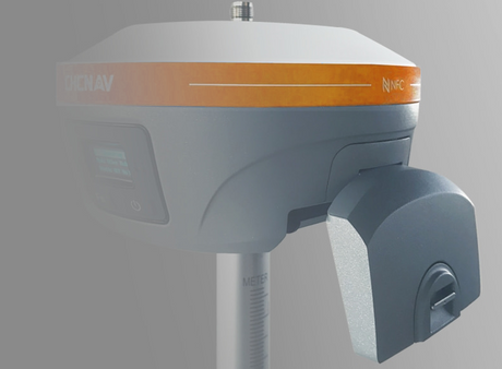
HQ-400
The HQ-400 is CHCNAV's lightweight integrated multibeam echosounder — compact enough to fit the Apache 4 / 4 Pro while delivering full MBES swath coverage. It also integrates into broader hydrographic workflows on larger USV and manned platforms.
HN-400W
The HN-400W Sonar Array is aimed at high-density swath mapping, detailed underwater terrain modelling, and advanced hydrographic applications including marine construction support, dredging verification, and infrastructure inspection where maximum data density is required.

Multibeam Processing Software and Hydrographic Data Workflows
Acquiring good data is only half the challenge. Processing quality determines whether field measurements become usable engineering deliverables. CHCNAV provides its own hydrographic and multibeam processing software — including CMS for multibeam workflows — and the broader ecosystem supports integration with industry-standard platforms including QPS Qimera, HYPACK/HYSWEEP, CARIS, BeamworX, and CAD/GIS-based downstream processing environments, depending on client standards and project requirements.
Practical takeaway: Serious hydrographic clients are not buying a sonar head in isolation. They are acquiring the capability to collect, clean, process, interpret, and deliver data within a defined workflow. Latnet Technologies provides the equipment and the technical support to make that workflow work on real Canadian projects.
Why USVs Are Becoming Standard for Bathymetric Surveys
For decades, hydrographic and bathymetric surveys on shallow, vegetated, or logistically difficult water bodies meant accepting either compromised access or the cost and risk of deploying a manned vessel. Unmanned Survey Vehicles (USVs) have changed that equation substantially.
- Access to shallow and weed-choked water bodies where manned vessels cannot safely operate
- Reduced crew requirements — many surveys can be completed by a single operator
- Improved safety by removing personnel from unstable or hazardous water environments
- More consistent survey lines through autonomous route-following rather than manual steering
- Better access near structures — bridges, dams, culverts, and revetments
- Multi-sensor capability — a single USV can carry echosounders, ADCPs, multibeam sonar, LiDAR, cameras, and SVP instruments
This sensor flexibility is why it is more accurate to describe Apache platforms as hydrographic survey platforms rather than bathymetric boats. The platform is the foundation; the mission is defined by the payload.
Selecting the Right Hydrographic Survey System for Your Project
| Survey Scenario | Recommended System | Why |
|---|---|---|
| Municipal stormwater pond survey | Apache 3 (D270) | Portable, shallow-water capable, and fast to deploy from the bank |
| Vegetated wetland or pond edge | Apache 3 Pro (D270) | Anti-entanglement design for demanding inland water environments |
| River discharge and hydrology | Apache 4 Lite + ADCP | Purpose-built for current profiling and discharge measurement |
| General hydrographic survey | Apache 4 / 4 Pro (D270) | Flexible multi-sensor platform for ADCP and sonar integration |
| Combined bathymetry and flow | Apache 4 Pro + ADCP | Simultaneous depth and discharge data collection in one pass |
| Sediment thickness and soft-bottom interpretation | Apache 4 Pro + D60 | Dual-frequency penetration for sediment layer discrimination |
| Compact multibeam survey | Apache 4 / 4 Pro + HQ-400 + SVP kit | Stage SVP profile first, then install HQ-400 for MBES acquisition |
| Large reservoir or lake multibeam | Apache 6 + HQ-400 or HN-400W + SVP | Simultaneous multibeam and SVP for continuous high-accuracy acquisition |
| Existing manned survey vessel | D390, D270, D60, ADCP, HQ-400, or HN-400W | Sensor upgrade path without requiring a USV platform |
| Topo-bathy and shoreline integration | Apache platform + LiDAR + sonar | Produces a seamless land-water terrain model for hydraulic and flood analysis |
The Hydrographic Sensor Stack: Integration Factors That Determine Data Quality
Survey-grade hydrographic data depends on more than the sonar transducer. Each component in the sensor stack contributes to — or detracts from — the reliability of the final deliverable.
GNSS RTK Positioning
Every depth sounding is only as valuable as its positional accuracy. GNSS RTK positioning georeferences each measurement to a real-world coordinate, connecting the acoustic depth model to a usable engineering datum. Without survey-grade positioning, depth data has no reliable spatial context.
IMU Motion Compensation
Vessel motion — roll, pitch, heave, yaw, and heading — directly distorts acoustic measurement geometry if not corrected. IMU integration provides the motion data needed to compensate for platform movement, particularly critical for multibeam swath accuracy on anything other than calm, flat water.
Sound Velocity and Water Temperature Correction
The entire acoustic depth measurement model depends on a known, representative sound speed. Water temperature stratification, salinity variation, and pressure effects all influence propagation velocity. Accurate SVP measurement and correction prevent systematic depth errors from accumulating across the survey area.
Obstacle Detection and Autonomous Navigation
Obstacle avoidance systems allow autonomous USV platforms to operate more safely near debris, submerged hazards, docks, embankments, and other obstructions — reducing the risk of sensor damage and improving mission completion rates on complex sites.
EasySail Field Software and Data Workflow
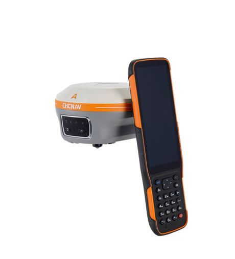
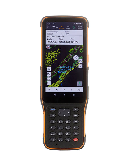
CHCNAV Apache USVs operate through the EasySail field software, which manages route planning, autonomous mission control, real-time depth monitoring, and onboard data handling. The workflow is designed to feel familiar to anyone who has planned a drone mapping mission — define the survey boundary, set line spacing, and let the platform execute.
For single-beam bathymetric surveys, data processing can be completed directly on the remote controller and exported to CAD, GIS, or reporting tools without a separate field computer. For ADCP and multibeam workflows, EasySail integrates with the broader data acquisition pipeline.
- Plan autonomous survey routes and line spacing from the remote controller
- Monitor depth, positioning, and survey status in real time
- Process single-beam bathymetric data and export results directly in the field
- Export to CAD, GIS, volume calculation, and reporting platforms
- Extend to ADCP and multibeam payload workflows as project scope requires
This is why serious hydrography is a systems discipline, not just a hardware procurement. The most reliable results come from the right combination of platform, sensor payload, positioning quality, correction methodology, and processing workflow — configured specifically for the project at hand.
Frequently Asked Questions About Hydrographic and Bathymetric Surveying
What is the difference between hydrographic surveying and bathymetric surveying?
Bathymetric surveying focuses specifically on measuring and mapping underwater terrain — the depth and shape of a water body's floor. Hydrographic surveying is broader: it includes bathymetric data collection alongside current profiling with ADCPs, multibeam sonar acquisition, environmental monitoring, and survey support for marine construction, inland waterways, and reservoir management. When a project involves more than depth measurement alone, hydrographic surveying is usually the more accurate term.
Can bathymetric surveys be completed without a manned boat?
Yes. Unmanned Survey Vehicles (USVs) remove the need for a manned boat on many inland survey projects. A compact USV can be launched directly from the bank and operated by a single person, making it well suited to stormwater ponds, reservoirs, canals, and shallow water bodies where deploying a conventional vessel is impractical, expensive, or unsafe.
Can ADCPs be used from manned vessels as well as USVs?
Yes. ADCPs are platform-agnostic and can be deployed from conventional survey boats, workboats, trimarans, or USVs. The choice of platform depends on site conditions, water depth, access constraints, and project requirements — not the instrument itself.
Can LiDAR be installed on a CHCNAV Apache USV platform?
Yes, depending on the payload configuration and project objective. LiDAR integration on Apache platforms is particularly useful for topo-bathy and shoreline workflows, where the underwater bathymetric model must connect seamlessly with above-water terrain data — a common requirement for hydraulic modelling, dam safety surveys, and floodplain mapping projects.
What field software do CHCNAV Apache USVs use?
CHCNAV Apache USVs use EasySail for survey route planning, autonomous mission control, real-time depth and status monitoring, and onboard data management. For single-beam bathymetric surveys, data can be processed and exported directly from the remote controller — without a separate field computer — into CAD, GIS, volume calculation, and reporting workflows.
Can the survey route be planned automatically on a USV?
Yes. EasySail supports automated survey route planning with configurable line spacing and coverage patterns, similar to planning a drone mapping mission. The USV then executes the planned route autonomously, improving line consistency and coverage repeatability compared to manual steering.
What software is used to process multibeam bathymetric data?
CHCNAV provides CMS for multibeam processing within its own software ecosystem. Many Canadian survey teams also use QPS Qimera, HYPACK/HYSWEEP, CARIS, or BeamworX depending on client specifications and internal processing standards. Downstream deliverables are typically produced in CAD or GIS environments.
Summary: Choosing the Right Hydrographic Survey Partner in Canada
Hydrographic and bathymetric surveying in Canada no longer requires large manned-vessel deployments as a default. CHCNAV's Apache USV platforms, hydrographic sensor range, ADCP systems, and multibeam solutions make survey-grade underwater mapping accessible and efficient for survey firms, municipalities, environmental consultants, and engineering teams working across the full range of Canadian water survey applications — from stormwater ponds and river discharge studies to large reservoir assessments, dredging support, and integrated topo-bathy workflows.
The right system is the one configured for the specific project: compact single-beam for accessible ponds, ADCP-focused for hydrology and discharge, dual-frequency for sediment interpretation, multibeam for dense 3D coverage, or LiDAR-assisted for above-and-below-water terrain integration.
As the authorized CHCNAV dealer in Canada, Latnet Technologies provides equipment supply, operator training, technical support, and project consultation across the full CHCNAV hydrographic ecosystem.

Ready to discuss your hydrographic survey project?
Contact Latnet Technologies Ltd. to find the right CHCNAV system for your application, request a product demonstration, or get a project consultation from our hydrographic survey specialists.
Get a Hydrographic Survey ConsultationQPS Qimera®, HYPACK®/HYSWEEP®, CARIS® and BeamworX® are trademarks of their respective owners. References are for interoperability and informational purposes only and do not imply affiliation or endorsement.