Welcome to LATNET store!

High-end geospatial solutions and equipment.

Book live Demo now.

Equipment Rentals, Canada-Wide

Professional Geospatial Equipment for Rent: RTK, LiDAR, SLAM, UAV & Hydrographic Systems

Whether you're a survey crew on a one-off corridor job, a construction firm needing RTK GNSS for a single season, or an engineering office evaluating UAV LiDAR before buying, renting from LATNET makes financial and operational sense. Based in Calgary, we ship precision survey gear across Alberta, British Columbia, Saskatchewan, Ontario, and the rest of Canada. Every rental includes direct technical support from our geospatial team, not a call centre.

24h
Dispatch
3 Day
Minimum term
10+
Systems
CA
Nation-wide
Request a Rental Quote Call +1 (403) 397-2210
CHCNAV AA6D LiDAR X500 UAV rental Canada CHCNAV Apache 3 USV bathymetric rental Canada CHCNAV RS10 SLAM LiDAR scanner in use rental Canada
1Build your kitPick the equipment and dates online.
2We confirmAvailability, price and shipping within one business day.
3Ships in 24 hAnywhere in Canada, or pick up in Calgary.
4Return or extendNeed more time on site? Extend mid-rental.
Available Systems

Survey equipment available for rent across Canada

All systems are maintained, calibrated, and shipped complete with accessories. Daily and weekly rates are shown on each card.

CHCNAV Apache 3 USV bathymetric survey boat rental Canada bathymetric mapping
Bathymetric Survey

CHCNAV Apache 3 USV

Autonomous USV for bathymetric surveys, lake and river bed mapping, hydrographic data collection, and volume calculations in Canada. Read our complete bathymetric survey guide →

What's in the kit
Included
  • CHCNAV Apache 3 USV + EC10 remote controller
  • Single beam echosounder
  • 4× batteries & charger
  • Transport hard case
Optional add-onsCHCNAV iBase GNSS base station · CHCNAV i89 RTK rover
Included with rentalAccess to Latnet CORS RTK Network (Alberta coverage)
CHCNAV AA6D LiDAR + X500 UAV system rental Canada aerial survey
UAV LiDAR

CHCNAV AA6D LiDAR + X500 UAV System

Also available with the single-camera AlphaAir 6.

UAV-mounted aerial LiDAR system for corridor mapping, terrain modelling, forestry inventory, powerline inspection, and large-area 3D surveys in Canada. Not sure which LiDAR is right for your project? →

What's in the kit
Included
  • CHCNAV X500 multirotor UAV + remote controller
  • CHCNAV AA6D LiDAR payload
  • Battery set + charging station
  • CoPre data processing software (USB dongle)
Optional add-onsCHCNAV iBase GNSS base station · CHCNAV i89 RTK rover
Included with rentalAccess to Latnet CORS RTK Network (Alberta coverage)
CHCNAV AA6D LiDAR payload only rental Canada UAV LiDAR sensor
UAV LiDAR Payload

CHCNAV AA6D LiDAR Payload Only

Also available as the single-camera AlphaAir 6 payload.

Rent the AA6D sensor alone, compatible with your own UAV platform for aerial LiDAR mapping, corridor surveys, and 3D terrain capture

What's in the kit
Included
  • CHCNAV AA6D LiDAR payload
  • CoPre data processing software (USB dongle)
Optional add-onsCHCNAV X500 UAV + remote · Battery set · Charging station · CHCNAV iBase · CHCNAV i89 RTK rover
Included with rentalAccess to Latnet CORS RTK Network (Alberta coverage)
CHCNAV RS10 SLAM LiDAR scanner rental indoor outdoor 3D mapping
Handheld SLAM LiDAR

CHCNAV RS10 SLAM Scanner

Handheld SLAM LiDAR scanner with integrated GNSS RTK for indoor and outdoor 3D mapping: as-built surveys, BIM capture, tunnels, stockpiles, and corridor scanning without tripods or targets

What's in the kit
Included
  • CHCNAV RS10 SLAM scanner
  • LT800 tablet with SmartGo app
  • CoPre processing software (USB dongle)
  • 3× batteries
Optional add-onsCHCNAV iBase GNSS base station · CHCNAV i89 RTK rover
Included with rentalAccess to Latnet CORS RTK Network (Alberta coverage)
CHCNAV RS7 handheld SLAM LiDAR scanner rental indoor underground 3D mapping Canada
Handheld SLAM LiDAR

CHCNAV RS7 SLAM Scanner

Tactical-grade handheld SLAM LiDAR for indoor and underground 3D mapping: buildings, corridors, stairwells, tunnels, and GNSS-denied environments

What's in the kit
Included
  • CHCNAV RS7 SLAM scanner
  • Handle
  • 1× battery
  • CoPre processing software (USB dongle)
  • SmartGo app (Android phone or tablet)
Optional add-onsCHCNAV iBase GNSS base station · CHCNAV i89 RTK rover
Included with rentalAccess to Latnet CORS RTK Network (Alberta coverage)
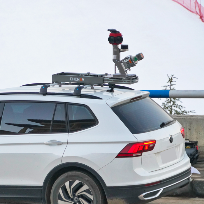
CHCNAV AU20 vehicle-mounted mobile LiDAR mapping system rental Canada
Mobile LiDAR

CHCNAV AU20 Mobile Mapping System

Vehicle-mounted mobile LiDAR mapping system for road and highway corridor surveys, utility and infrastructure mapping, asset inventory, and high-speed large-area 3D data collection

What's in the kit
Included
  • CHCNAV AU20 single-head LiDAR sensor unit
  • Kit configured for your vehicle and project. Ask us for the full contents.
Optional add-onsCHCNAV iBase GNSS base station · CHCNAV i89 RTK rover
Included with rentalAccess to Latnet CORS RTK Network (Alberta coverage)
CHCNAV iBase i89 RTK GNSS receiver rental Alberta topographic survey
RTK GNSS

CHCNAV iBase & i89 RTK System

Complete RTK GNSS base-and-rover system for topographic surveys, construction stakeout, boundary surveys, and GIS data collection across Canada. RTK GNSS buyer's guide →

What's in the kit
Included
  • CHCNAV iBase GNSS base station
  • CHCNAV i89 Visual IMU-RTK rover
  • HCE600 controller with LandStar 8
  • Tripod, range pole, accessories
Included with rentalAccess to Latnet CORS RTK Network (Alberta coverage)
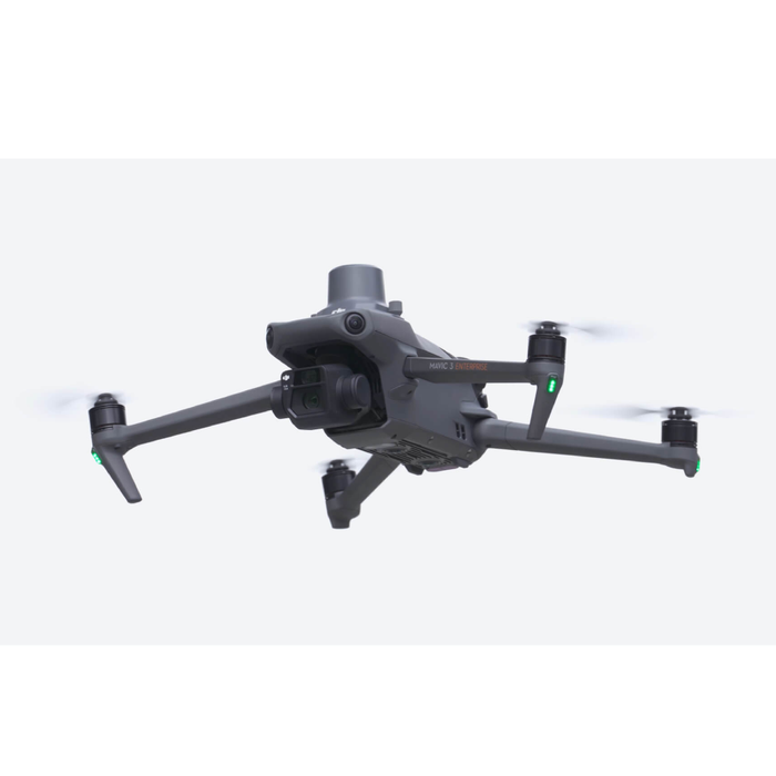
DJI Mavic 3 Enterprise RTK drone rental Canada photogrammetry survey
UAV Photogrammetry

DJI Mavic 3 Enterprise RTK

Compact RTK drone for aerial photogrammetry, orthophoto and DSM production, construction site progress monitoring, and volumetric surveys

What's in the kit
Included
  • DJI Mavic 3 Enterprise with RTK module
  • 4× flight batteries
Optional add-onsCHCNAV iBase GNSS base station · CHCNAV i89 RTK rover
Included with rentalAccess to Latnet CORS RTK Network (Alberta coverage)
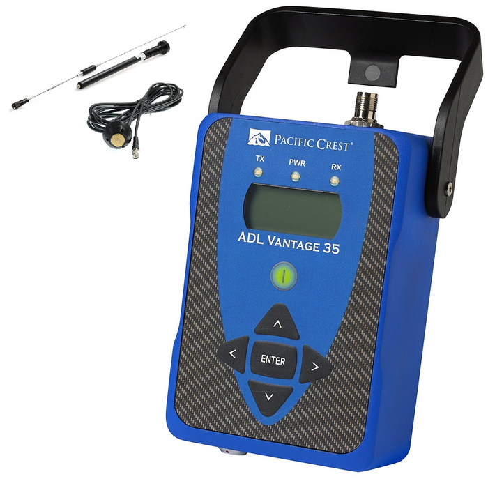
Pacific Crest ADL Vantage UHF radio base station rental GNSS survey
GNSS Infrastructure

Pacific Crest ADL Vantage 35/Pro UHF Radio

UHF radio base station for delivering RTK corrections in remote areas without cellular coverage, essential for rural and northern survey projects across Alberta and Canada

What's in the kit
Included
  • Pacific Crest ADL Vantage 35/Pro UHF radio
  • Utility gain antenna + antenna cable
Optional add-on12V external battery
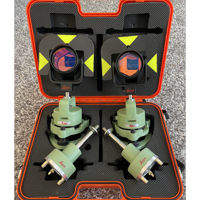
Leica traverse kit prism tribrach rental total station survey control
Control & Traverse

Leica Traverse Kit

Professional prism and tribrach set for total station traverse surveys, control point establishment, and precise angular and distance measurements

What's in the kit
Included
  • 2× Leica GDF321 tribrach
  • 2× Leica GZR3 carrier
  • 2× Leica GPR121 circular prism
Optional add-on2× Leica GRT146 carrier

Before you book

  • Business rentals: we verify the company (website or company email) before dispatch, usually the same day.
  • Insurance: the equipment must be covered by your insurance for its full replacement value during the rental.
  • No payment online: we confirm availability, price and shipping, then email your rental agreement within one business day.
  • Shipping: dispatched within 24 hours of confirmation, anywhere in Canada. Local pickup in Calgary. Shipping days don't count toward your rental.
Book Online

Book your rental in minutes

Build your kit, mark your dates on the calendar, and send the request. We confirm availability and email your rental agreement within one business day. No payment is taken online.

1

Build your kitCombine as many units as you need. Everything ships together.

No equipment selected yet. Choose a unit above to start your booking.
2

Select your rental datesClick a start date, then an end date. 3-day minimum, weekly rate from 7 days.

Shipping days don't count: the clock starts when the gear reaches your site.

Booked— add equipment above to see its availability.
Start: —
End: —
Duration: —
3

Training & data servicesOptional: from a quick online training session to finished deliverables, we've got you covered.

4

Company & delivery detailsFields marked * are required.

A company-domain email speeds up approval.
Why we ask: rental equipment is dispatched to verified businesses and professionals only. A company website or company-domain email lets us approve your booking faster, usually the same day.

Booking summary

Your kit is empty.
Dates—
Data processingNone
Estimated total—
3–6 day rentals use the short-term daily rate; 7+ days switch to the lower weekly rate. Estimate before taxes and delivery. Final quote confirmed by our team, no payment taken now.
LATNET CORS Network, Alberta

Rent GNSS equipment and use our own RTK correction network.

Latnet operates its own CORS base station network covering parts of Alberta. When you rent a GNSS receiver from us, you can connect to our network for RTK corrections via NTRIP, with no base station setup in covered areas. Every GNSS rental includes access.

  • NTRIP corrections over cellular, no radio infrastructure needed
  • Eliminates base station setup time on every project
  • Compatible with all CHCNAV GNSS receivers in our rental fleet
  • Ask us about current coverage for your project area. Learn how RTK corrections work →
Latnet CORS Network
Coverage areaAlberta (expanding)
Correction typeRTK / NTRIP
CompatibilityAll CHCNAV GNSS receivers
ConnectionCellular (no radio required)
Base station neededNo (in covered areas)

Tell us your project area when requesting a quote. We'll confirm coverage and include network credentials with your rental kit.

FAQ

Rental questions, answered

How much does it cost to rent survey equipment from Latnet?

Our rates are published right on this page. Build your kit in the booking section and you'll see daily and weekly rates for every system, with a live estimate for your dates. 3–6 day rentals use a short-term daily rate; from 7 days the lower weekly rate applies automatically.

What is the minimum rental period?

Our minimum rental period is 3 days. Rentals of 3–6 days are billed at the short-term daily rate; rentals of 7 days or more switch to the lower weekly rate. The AU20 mobile mapping system is available on weekly terms only.

Do you ship rental equipment outside Alberta?

Yes. We ship rental systems across Canada: British Columbia, Saskatchewan, Ontario, Quebec, and beyond. Local pickup is also available at our Calgary location. Shipping costs and timelines are included with your quote.

How quickly can you dispatch a rental system?

We dispatch confirmed rental systems within 24 hours. Confirmed bookings usually ship the same or next business day. We recommend booking at least a few days ahead when possible to confirm availability.

Does the rental include technical support and training?

Yes. Every rental includes direct access to our technical team by phone and email throughout the rental period: field setup guidance, software questions, and workflow troubleshooting. For new operators we can arrange an onboarding call before the system ships.

Can I use the Latnet CORS network with a rented GNSS receiver?

Yes, and this is a real advantage of renting from us. Latnet operates its own CORS RTK correction network covering parts of Alberta. If your project falls within our coverage area, you can use NTRIP corrections from our network without setting up a base station. We'll confirm coverage and include credentials with your rental.

What happens if equipment is damaged during a rental?

The renter is fully responsible for any damage, loss, or theft during the rental period. You are required to have adequate insurance coverage for the full replacement value of the rented equipment before it ships. Most clients cover rental equipment under their existing contractor's all-risk or equipment floater policy. Confirm with your insurer before your rental starts. Rental terms and liability details are set out in our rental agreement provided at booking.

Why Rent with Latnet

The rental program built for working surveyors

Fast logistics, genuine technical support, and field-ready systems shipped complete, so your crew is productive the day the gear lands.

Canada-wide survey equipment rental shipping

Canada-Wide Coverage

Ship precision geospatial equipment coast to coast. Local pickup available in Calgary.

24-hour dispatch survey equipment rental

24-Hour Dispatch

Confirmed bookings ship within 24 hours. No long lead times.

Expert technical support geospatial equipment rental

Expert Technical Support

Direct access to our geospatial team: field setup, software questions, and workflow troubleshooting throughout your rental.

Latnet CORS RTK network access included with GNSS equipment rentals

CORS Network Included

Rentals include access to the LATNET CORS RTK network: NTRIP corrections with no base station setup in covered areas.

Ready to get started?

Tell us what you need and your project dates. We'll confirm availability and pricing the same day.

Book Online →Call +1 (403) 397-2210