Machine control · Canada · Alberta · Saskatchewan · Manitoba · BC · Ontario
Dozer and excavator machine control in Canada: stop paying for dirt twice
Every centimetre a blade runs too deep turns into fill you have to buy, haul and compact. Every centimetre too high means another pass, more diesel out the stack and more hours on the meter. Here's what that really costs, how 3D guidance and control fix it, and what CHCNAV machine control from LATNET could save your crew.
LATNET Technologies, CalgaryAuthorized CHCNAV dealerNovember 2026About 12 min · interactive
Same pad, two ways: by eye vs CHCNAV 3D control
1 · Without machine control2 · Install CHCNAV TD63 PRO3 · With machine control4 · Savings
Without machine control · grading by eyeBlade: lowering to grade
Cost of this strip$0
0passes
0 minmachine time
0 Ldiesel burned
0 m³fill to buy
$0cost of this strip
Design surfaceOn designToo high: another passToo deep: buy fill
42 m strip, 4.3 m blade, finish grading a pad with a crown and 2% cross slope. Heights are exaggerated 3x so you can see the errors. The in-cab screen is a simplified illustration of the CHCNAV cut/fill view. Drag to look around.
Key takeaways
Grading and digging by eye wastes money: overcuts need fill, high spots need extra passes, and stakes and grade checks need a surveyor.
In the simulated examples on this page, CHCNAV 3D machine control is estimated to save about $12,000 on one 2 ha pad and about $19,500 per kilometre of ditch. These are illustrations, not guaranteed results.
Automatic control (TD63 PRO for dozers, TG63 for graders) moves the blade for the operator. 3D guidance (TX63, TX73 and EasyNAV EMG100 for excavators) shows the operator exactly where to dig.
The EasyNAV EMG100 is very popular with farmers because it is easy to use and very affordable.
LATNET in Calgary sells, installs and supports CHCNAV machine control across Canada: Alberta, Saskatchewan, Manitoba, British Columbia and Ontario.
On most grading jobs nobody sees the money leaving. It goes out in small pieces: an extra pass here, a low spot there, a grade checker walking behind the dozer all day, a load of fill to patch an overcut. 3D machine control puts the design surface in the cab, so the blade or bucket stops where the drawing says it should.
Practical reality: the machine is the most expensive thing on site, and it's paid by the hour whether it's making grade or chasing it. Machine control doesn't make the dozer faster. It stops the dozer from doing the same work twice.
Where the money goes on a grading job
Blade too deep: you pay to put the dirt back
An overcut can't be fixed with the blade. The low spot needs imported fill, placed in lifts and compacted, often with density testing on structural pads. On a road subgrade or building pad, a few centimetres too deep across a large area quickly turns into truckloads of material, a compactor, a water truck and a day you didn't plan for.
Blade too high: diesel goes out the stack
Leaving material above grade feels safer, but the dozer has to come back. Every extra pass burns fuel, puts hours on the machine and the operator, and pushes the finish date. When the operator is guessing, it usually takes two or three passes to sneak up on grade, plus a surveyor or grade checker to tell them when to stop.
Stakes and grade checking
Without machine control someone has to set stakes, re-set the ones the machine knocks over, and stand next to the blade with a rod. That's paid time, and on an excavation it means a person working next to a moving bucket or down in a trench.
Guidance or control: two ways to put the design in the cab
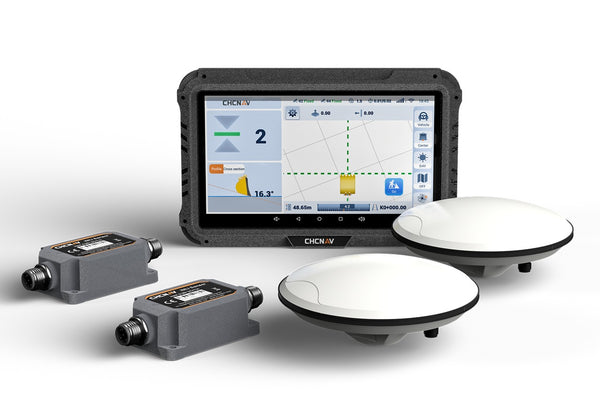
CHCNAV machine control comes in two kinds. Both use dual GNSS antennas and an IMU to know exactly where the blade or bucket is, and both compare it to your 3D design in real time. The difference is who moves the hydraulics.
3D guidance
The operator sees it, the operator moves it
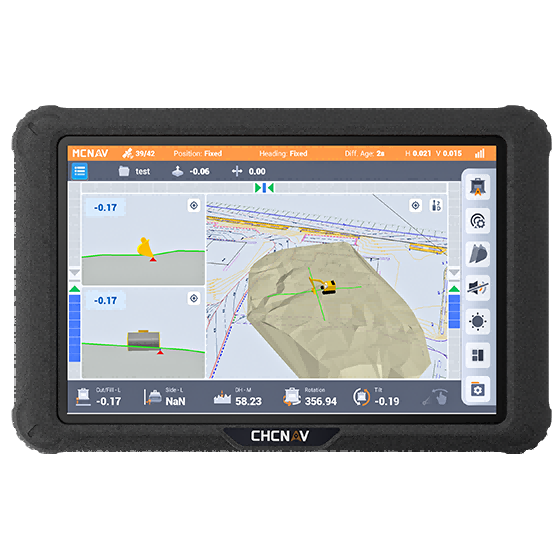
A screen in the cab shows the bucket on the design with cut and fill numbers, so the operator digs straight to grade without stakes or a checker. Ideal for excavators on trenches, footings, ditches and slopes.
CHCNAV: TX63, TX73, EasyNAV EMG100
3D automatic control
The system moves the blade for you
The system drives the blade hydraulics automatically to hold grade while the operator steers and pushes. Ideal for dozers and graders on pads, roads and fine grade.
CHCNAV: TD63 PRO for dozers, TG63 for graders
Digging a ditch: by eye vs CHCNAV TX73 guidance
1 · Stakes, dig by eye, check, rework2 · Install TX73, load design3 · Dig with guidance4 · Savings
Digging a ditch without guidanceDesign: 1.25 m deep, 0.5% fall
Cost of this ditch$0
0bucket passes
0 minexcavator time
0 Ldiesel burned
0 minsurveyor time
$0cost of this ditch
Design ditchOn designToo shallow: dig againToo deep or off line: fill
20 m of a 1.25 m deep ditch with 1:1 side slopes and 0.5% fall. Each bucket pass is a time-lapse of several real cycles. The TX73 screen is a simplified illustration of CHCNAV's cut/fill guidance view. Drag to look around.
How much could machine control save you?
Put in your own numbers. The defaults are a starting point for one mid-size machine in an Alberta season; they're assumptions, not promises.
Estimated savings per year
$0
Machine hours freed up0 hDiesel not burned0 LCO₂ not emitted0 tPaybackEnter your quote
Assumes machine control cuts extra passes and rework to about 5% of machine time, and removes about 70% of staking and grade checking. The result is an estimate for illustration only, not a quote or a guarantee of savings. Actual results depend on your machines, operators, soil, site conditions and designs. Ask us for an assessment of your own projects.
CHCNAV machine control from LATNET
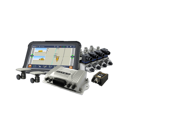
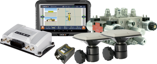
High quality, without the big-brand price. CHCNAV systems are built the same way as the big-name systems: dual GNSS antennas, high-rate IMU sensors, rugged IP67 and IP68 components and full 3D design support. They cost much less, and LATNET installs, calibrates, trains and supports them from Calgary.
Dozer · automatic control
TD63 PRO
Holds the blade on your 3D design automatically, so the operator steers and pushes while the system makes grade. Finished grade in fewer passes, no stakes.
Dual GNSS + 100 Hz IMUCentimetre-level blade controlInstalls in under 6 h, calibrates in 30 min2D and 3D modes10.1″ MCNAV tabletIP67 IMU, IP68 antennas
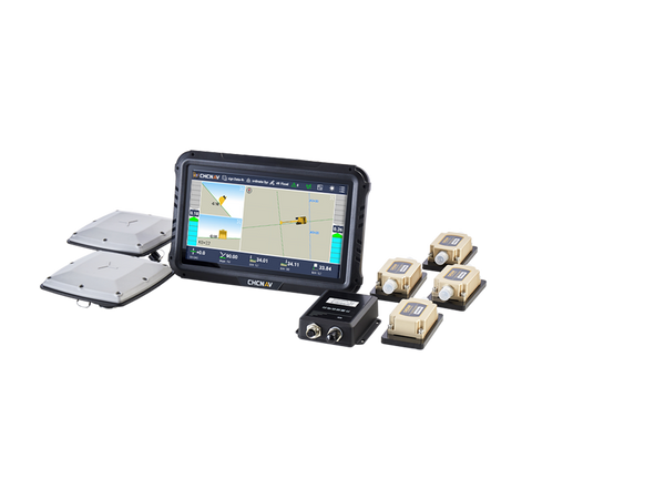
Very popular with farmers because it is easy to use and very affordable. Real-time bucket position on a rugged touchscreen for drainage ditches, dugouts, field approaches, levelling and slopes.
Popular with farmersVery affordableLearn it in about 30 minInstalls in under 2 hSwing boom, tilt and offset boomUp to 30% more productive*
Holds the blade on the design surface automatically; works with dozers with hydraulic pilot valves
Motor grader: roads, subgrade, final grade
TG63
Automatic control
±2 cm automatic blade control, auto and manual switches in the cab
Excavator: trenches, footings, ditches, slopes
TX63
3D guidance
±3 cm, dual GNSS, 2D and 3D modes, tilt buckets
Excavator: advanced work, tiltrotators, remote support
TX73
3D guidance
IP69K IMU sensors, RTK receiver, 10.1″ display, tiltrotator support, iSite cloud sync and remote help
Excavator: farms, drainage, first step into 3D
EasyNAV EMG100
3D guidance
Very popular with farmers: easy to use, very affordable, learned in about 30 minutes
Machine control across Canada
LATNET is based in Calgary and supplies CHCNAV machine control to contractors, municipalities and farms across Canada. We install and calibrate on site, load your design files, train your operators and support you remotely, wherever you work.
Alberta: lease and well-site pads, subdivision grading, roads and municipal ditches, with corrections from the LATNET RTK network.
Saskatchewan: yard and grain-bin pads, farm drainage, road grading and dugouts.
Manitoba: drainage ditches, culverts, road subgrade and field approaches.
British Columbia: site preparation, slopes, utility trenching and building pads.
Ontario: subdivisions, building pads, municipal drainage and road work.
EasyNAV EMG100: the farmer's favourite
For farms, the EasyNAV EMG100 is the system we get asked about most. It is very popular with farmers because it is easy to use and very affordable. Most operators learn it in about 30 minutes, it installs in under 2 hours, and the touchscreen shows the bucket against the design in real time. Dig drainage ditches with the right fall, clean out dugouts, set culverts and build field approaches without waiting for a surveyor. Farmers in Alberta, Saskatchewan and Manitoba use it on their own excavators between seeding and harvest, and in the off-season.
Machine control needs centimetre RTK positioning. CHCNAV systems can take corrections from a UHF base on site or over the internet (NTRIP), and that's where the LATNET RTK network comes in: corrections from our own NRCan-registered reference stations in Alberta, straight to the machine over cellular. No base to set up and guard on every job, and every machine on site works on the same coordinates. Outside Alberta, the same systems run on a UHF base on site, and we can look at adding a LATNET station where there is enough work.
One supplier for the whole stack. LATNET supplies the machine control, the RTK corrections, the rover for checking grade and the training. If something isn't right on site, it's one phone call.
The question isn't whether machine control pays for itself. It's how many overcuts, extra passes and grade-checking days you're paying for while you wait to decide.
Frequently asked questions
What's the difference between machine guidance and machine control?
Guidance shows the operator where the blade or bucket is compared with the design, with cut and fill numbers on a screen, and the operator moves the levers. Control goes one step further and moves the hydraulics automatically to hold grade. CHCNAV's TX63, TX73 and EasyNAV EMG100 are excavator guidance systems; the TD63 PRO (dozers) and TG63 (graders) are automatic control systems.
How much money can machine control save?
It depends on your machines, crews and jobs. The savings come from fewer extra passes, less diesel, much less staking and grade checking, and fewer overcuts that need fill. Use the calculator on this page with your own numbers for an estimate, or send us a job and we'll run it with you. Any figure is an estimate, not a guarantee.
Are CHCNAV systems as good as the big brands?
They're built the same way: dual GNSS antennas, high-rate IMU sensors, rugged IP67 and IP68 components and full 3D design support, with accuracy from about ±2 to ±3 cm depending on the system. The difference is the price, which is much lower, and LATNET supports them locally from Calgary.
Will it fit my machine?
The TD63 PRO works with dozers that have hydraulic pilot valves, the TG63 fits motor graders, the TX63 and TX73 work with excavators including tilt buckets (and tiltrotators on the TX73), and the EasyNAV EMG100 supports swing boom, tilt bucket and offset boom excavators. Send us the make and model and we'll confirm.
How long does installation take?
CHCNAV quotes under 2 hours for the EasyNAV EMG100, under 4 hours for the TX63, and under 6 hours plus about 30 minutes of calibration for the TD63 PRO. Most machines are back to work the same day.
Do I need a base station on site?
No. CHCNAV machine control can take RTK corrections over the internet (NTRIP) from the LATNET RTK network, so there's no base to set up and guard on every job. A UHF base on site is also supported where there's no cell coverage.
Is the EasyNAV EMG100 a good fit for farms?
Yes. The EasyNAV EMG100 is very popular with farmers because it is easy to use and very affordable. Most operators learn it in about 30 minutes, it installs in under 2 hours, and it shows the bucket against the design for drainage ditches, dugouts, culverts, field approaches and yard pads. Farms across Alberta, Saskatchewan and Manitoba use it to dig ditches to grade without a surveyor on site.
Do you sell and support machine control outside Alberta?
Yes. LATNET is based in Calgary and supplies CHCNAV machine control across Canada, including Alberta, Saskatchewan, Manitoba, British Columbia and Ontario. We install and calibrate on site, load your design files, train your operators and support you remotely. In Alberta the systems can run on the LATNET RTK network; anywhere else they run on a UHF base on site.
What design files do I need?
A 3D design surface or alignment from your engineer or surveyor. The TG63 works directly with DXF designs, and LATNET can help you get your design loaded and checked before the machine starts.
Get a quote for your machines
Tell us what you run and what you're building. We'll recommend the right CHCNAV system, quote it installed, and show you what it would save on your next job.
📞 (403) 397-2210 📍 Calgary, Alberta. Installation and support across Canada: Alberta, Saskatchewan, Manitoba, British Columbia and Ontario.
Stop paying for dirt twice
CHCNAV dozer, grader and excavator machine control, installed and supported by LATNET, running on the LATNET RTK network.
Machine Control CanadaDozer GPS3D Excavator GuidanceGrader ControlCHCNAVLATNET RTKAlbertaSaskatchewanManitobaBritish ColumbiaOntarioFarm DrainageEasyNAV
Disclaimer: the 3D animations, savings tables and calculator on this page are simplified simulations based on typical assumptions and the values you enter. All savings figures are estimates for illustration only and are not a quote, a performance claim or a guarantee of savings. Actual results depend on your machines, operators, soil and site conditions, designs and how the system is used. LATNET can provide an assessment for your own projects on request. Product details come from CHCNAV product information. CHCNAV, TD63, TG63, TX63, TX73, EasyNAV, MCNAV, GradeNav and iSite are trademarks of CHC Navigation.
Every centimetre a dozer blade runs too deep turns into fill you have to buy, haul and compact, and every centimetre too high means another pass. See it in interactive...
CHCNAV NX510, NX610 and NX612 auto-steer, Guide 10 guidance and HG100 harvester row guidance, the three types of tractor steering, free vs satellite vs RTK corrections, and how to run...
A practical surveyor's guide to UHF radio links in GNSS RTK — channel spacing, GMSK vs 4FSK, FEC, TRIMTALK, SATEL, Pacific Crest protocols, and how to get the most range...
Hydrographic Surveying · Bathymetric Mapping · Canada Hydrographic and Bathymetric Surveying Systems: A Complete Guide to USVs, ADCPs, and Multibeam Sonar From stormwater pond surveys and reservoir sediment studies to...
Complete guide to GNSS corrections — RTK, NTRIP, RTCM MSM, CORS and PPP for centimeter-accurate surveying, precision agriculture, machine control, and UAV mapping. Includes the technical reasons accuracy fails, base...
A practical buyer's guide to choosing GNSS RTK equipment — receivers, rovers, and base stations — for Canadian surveyors, construction crews, and geomatics professionals. This guide walks through the ten...
Discover how advanced GNSS receivers, such as those with integrated IMU and dual-camera technology, are transforming precision mapping and surveying. Learn about multi-constellation tracking, multipath mitigation, and real-time corrections that...
A practical guide to the CHCNAV RS7 and RS10 handheld SLAM LiDAR scanners — how SLAM and INS positioning work, when loop closure is and isn't needed, which scanner suits...
When choosing a LiDAR for precision mapping, critical specs include accuracy, weight, scan speed, and more. CHCNAV’s AA10 and AU20 systems excel with high precision, multiple returns, versatile integration, and...